You are here: Home > Network List > US - United States National Seismic Network Stations List
> Station DUG Dugway, Tooele County, Utah, USA > Earthquake Result Viewer
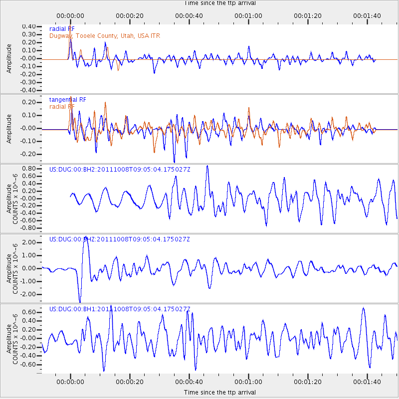
DUG Dugway, Tooele County, Utah, USA - Earthquake Result Viewer
*The percent match for this event was below the threshold and hence no stack was calculated.
| Earthquake location: |
Tonga Islands |
| Earthquake latitude/longitude: |
-20.6/-173.2 |
| Earthquake time(UTC): |
2011/10/08 (281) 08:53:11 GMT |
| Earthquake Depth: |
6.0 km |
| Earthquake Magnitude: |
6.1 MB, 5.6 MS, 5.9 MW, 5.9 MW |
| Earthquake Catalog/Contributor: |
WHDF/NEIC |
|
| Network: |
US United States National Seismic Network |
| Station: |
DUG Dugway, Tooele County, Utah, USA |
| Lat/Lon: |
40.19 N/112.81 W |
| Elevation: |
1477 m |
|
| Distance: |
82.6 deg |
| Az: |
42.201 deg |
| Baz: |
235.24 deg |
| Ray Param: |
$rayparam |
*The percent match for this event was below the threshold and hence was not used in the summary stack. |
|
| Radial Match: |
68.16069 % |
| Radial Bump: |
400 |
| Transverse Match: |
77.382385 % |
| Transverse Bump: |
400 |
| SOD ConfigId: |
558545 |
| Insert Time: |
2013-09-19 04:04:55.429 +0000 |
| GWidth: |
2.5 |
| Max Bumps: |
400 |
| Tol: |
0.001 |
|
Signal To Noise
| Channel | StoN | STA | LTA |
| US:DUG:00:BHZ:20111008T09:05:04.175027Z | 7.9454503 | 1.2181204E-6 | 1.5331042E-7 |
| US:DUG:00:BH1:20111008T09:05:04.175027Z | 0.8861548 | 1.4067048E-7 | 1.5874257E-7 |
| US:DUG:00:BH2:20111008T09:05:04.175027Z | 1.4641638 | 2.3914836E-7 | 1.6333445E-7 |
| Arrivals |
| Ps | |
| PpPs | |
| PsPs/PpSs | |


