You are here: Home > Network List > US - United States National Seismic Network Stations List
> Station EGMT Eagleton, Montana, USA > Earthquake Result Viewer
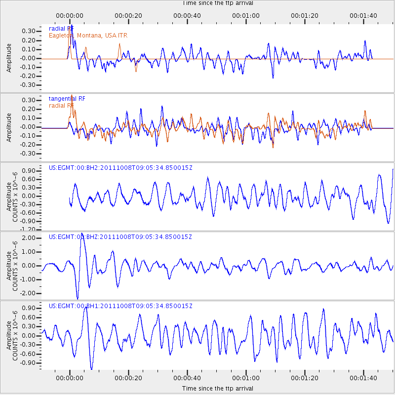
EGMT Eagleton, Montana, USA - Earthquake Result Viewer
*The percent match for this event was below the threshold and hence no stack was calculated.
| Earthquake location: |
Tonga Islands |
| Earthquake latitude/longitude: |
-20.6/-173.2 |
| Earthquake time(UTC): |
2011/10/08 (281) 08:53:11 GMT |
| Earthquake Depth: |
6.0 km |
| Earthquake Magnitude: |
6.1 MB, 5.6 MS, 5.9 MW, 5.9 MW |
| Earthquake Catalog/Contributor: |
WHDF/NEIC |
|
| Network: |
US United States National Seismic Network |
| Station: |
EGMT Eagleton, Montana, USA |
| Lat/Lon: |
48.02 N/109.75 W |
| Elevation: |
1055 m |
|
| Distance: |
88.8 deg |
| Az: |
36.923 deg |
| Baz: |
236.966 deg |
| Ray Param: |
$rayparam |
*The percent match for this event was below the threshold and hence was not used in the summary stack. |
|
| Radial Match: |
64.79673 % |
| Radial Bump: |
400 |
| Transverse Match: |
59.297188 % |
| Transverse Bump: |
400 |
| SOD ConfigId: |
558545 |
| Insert Time: |
2013-09-19 04:05:05.001 +0000 |
| GWidth: |
2.5 |
| Max Bumps: |
400 |
| Tol: |
0.001 |
|
Signal To Noise
| Channel | StoN | STA | LTA |
| US:EGMT:00:BHZ:20111008T09:05:34.850015Z | 8.7486515 | 1.3414398E-6 | 1.5333103E-7 |
| US:EGMT:00:BH1:20111008T09:05:34.850015Z | 1.3193934 | 3.5876047E-7 | 2.719132E-7 |
| US:EGMT:00:BH2:20111008T09:05:34.850015Z | 1.583411 | 3.6040348E-7 | 2.2761209E-7 |
| Arrivals |
| Ps | |
| PpPs | |
| PsPs/PpSs | |


