You are here: Home > Network List > CN - Canadian National Seismograph Network Stations List
> Station INK INUVIK, NT, CANADA.ANADA > Earthquake Result Viewer
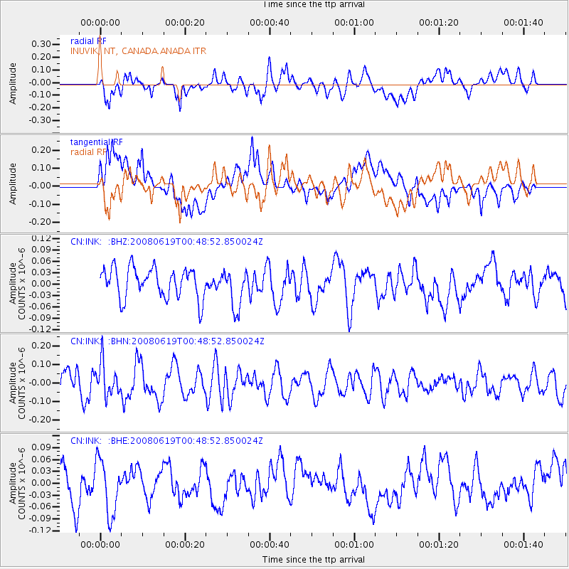
INK INUVIK, NT, CANADA.ANADA - Earthquake Result Viewer
*The percent match for this event was below the threshold and hence no stack was calculated.
| Earthquake location: |
New Britain Region, P.N.G. |
| Earthquake latitude/longitude: |
-4.9/151.8 |
| Earthquake time(UTC): |
2008/06/19 (171) 00:36:45 GMT |
| Earthquake Depth: |
143 km |
| Earthquake Magnitude: |
5.5 MW, 5.2 MB, 5.4 MW |
| Earthquake Catalog/Contributor: |
WHDF/NEIC |
|
| Network: |
CN Canadian National Seismograph Network |
| Station: |
INK INUVIK, NT, CANADA.ANADA |
| Lat/Lon: |
68.31 N/133.52 W |
| Elevation: |
40 m |
|
| Distance: |
89.0 deg |
| Az: |
21.021 deg |
| Baz: |
254.011 deg |
| Ray Param: |
$rayparam |
*The percent match for this event was below the threshold and hence was not used in the summary stack. |
|
| Radial Match: |
60.366238 % |
| Radial Bump: |
400 |
| Transverse Match: |
54.301937 % |
| Transverse Bump: |
400 |
| SOD ConfigId: |
2504 |
| Insert Time: |
2010-02-27 06:28:39.211 +0000 |
| GWidth: |
2.5 |
| Max Bumps: |
400 |
| Tol: |
0.001 |
|
Signal To Noise
| Channel | StoN | STA | LTA |
| CN:INK: :BHN:20080619T00:48:52.850024Z | 1.8965114 | 9.043506E-8 | 4.7684953E-8 |
| CN:INK: :BHE:20080619T00:48:52.850024Z | 1.3587605 | 7.326036E-8 | 5.3917056E-8 |
| CN:INK: :BHZ:20080619T00:48:52.850024Z | 1.3398142 | 5.3118384E-8 | 3.9646082E-8 |
| Arrivals |
| Ps | |
| PpPs | |
| PsPs/PpSs | |


