You are here: Home > Network List > IU - Global Seismograph Network (GSN - IRIS/USGS) Stations List
> Station PMG Port Moresby, New Guinea > Earthquake Result Viewer
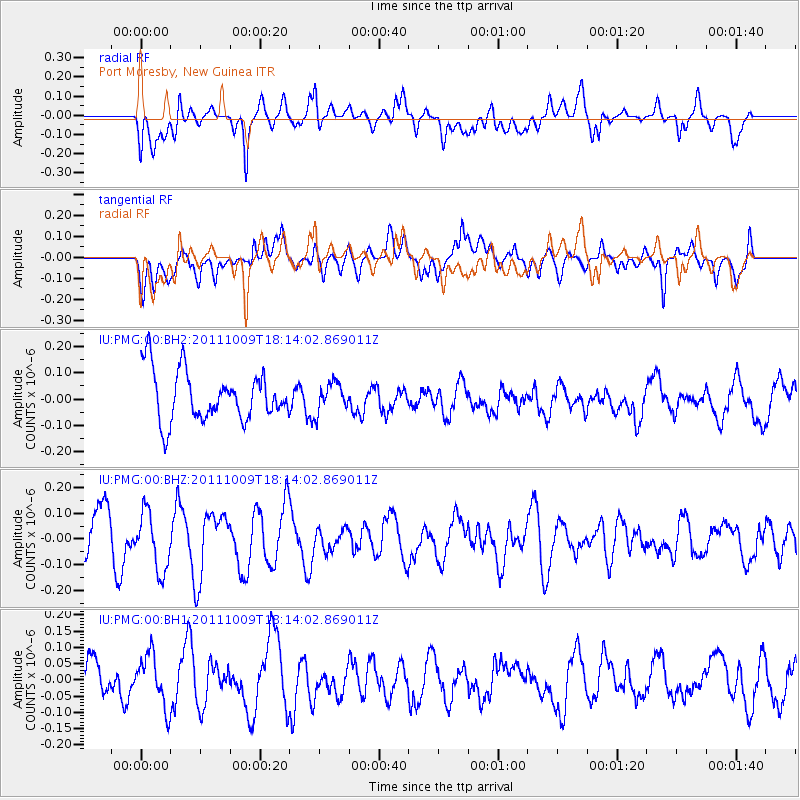
PMG Port Moresby, New Guinea - Earthquake Result Viewer
*The percent match for this event was below the threshold and hence no stack was calculated.
| Earthquake location: |
Southern East Pacific Rise |
| Earthquake latitude/longitude: |
-50.1/-116.0 |
| Earthquake time(UTC): |
2011/10/09 (282) 18:01:47 GMT |
| Earthquake Depth: |
10 km |
| Earthquake Magnitude: |
5.5 MW |
| Earthquake Catalog/Contributor: |
NEIC PDE/NEIC PDE-M |
|
| Network: |
IU Global Seismograph Network (GSN - IRIS/USGS) |
| Station: |
PMG Port Moresby, New Guinea |
| Lat/Lon: |
9.40 S/147.16 E |
| Elevation: |
90 m |
|
| Distance: |
87.3 deg |
| Az: |
258.741 deg |
| Baz: |
140.178 deg |
| Ray Param: |
$rayparam |
*The percent match for this event was below the threshold and hence was not used in the summary stack. |
|
| Radial Match: |
57.537693 % |
| Radial Bump: |
400 |
| Transverse Match: |
44.162235 % |
| Transverse Bump: |
400 |
| SOD ConfigId: |
558545 |
| Insert Time: |
2013-09-19 04:07:41.264 +0000 |
| GWidth: |
2.5 |
| Max Bumps: |
400 |
| Tol: |
0.001 |
|
Signal To Noise
| Channel | StoN | STA | LTA |
| IU:PMG:00:BHZ:20111009T18:14:02.869011Z | 0.92475826 | 1.1462936E-7 | 1.2395603E-7 |
| IU:PMG:00:BH1:20111009T18:14:02.869011Z | 1.0954148 | 8.247993E-8 | 7.529562E-8 |
| IU:PMG:00:BH2:20111009T18:14:02.869011Z | 0.58343214 | 5.501525E-8 | 9.4295885E-8 |
| Arrivals |
| Ps | |
| PpPs | |
| PsPs/PpSs | |


