You are here: Home > Network List > US - United States National Seismic Network Stations List
> Station WMOK Wichita Mountains, Oklahoma, USA > Earthquake Result Viewer
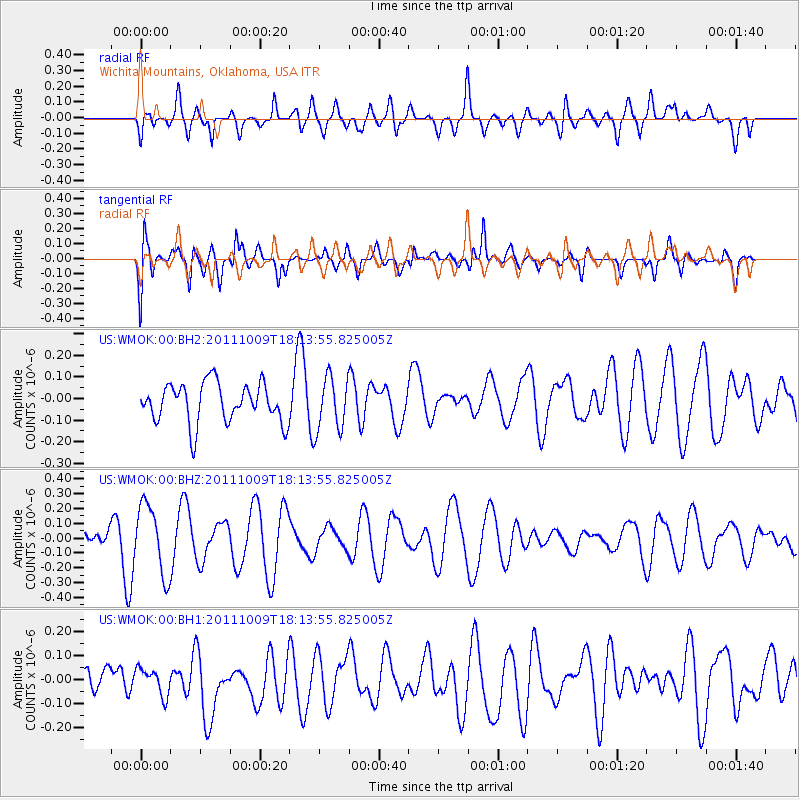
WMOK Wichita Mountains, Oklahoma, USA - Earthquake Result Viewer
*The percent match for this event was below the threshold and hence no stack was calculated.
| Earthquake location: |
Southern East Pacific Rise |
| Earthquake latitude/longitude: |
-50.1/-116.0 |
| Earthquake time(UTC): |
2011/10/09 (282) 18:01:47 GMT |
| Earthquake Depth: |
10 km |
| Earthquake Magnitude: |
5.5 MW |
| Earthquake Catalog/Contributor: |
NEIC PDE/NEIC PDE-M |
|
| Network: |
US United States National Seismic Network |
| Station: |
WMOK Wichita Mountains, Oklahoma, USA |
| Lat/Lon: |
34.74 N/98.78 W |
| Elevation: |
486 m |
|
| Distance: |
85.8 deg |
| Az: |
14.115 deg |
| Baz: |
190.999 deg |
| Ray Param: |
$rayparam |
*The percent match for this event was below the threshold and hence was not used in the summary stack. |
|
| Radial Match: |
54.36833 % |
| Radial Bump: |
400 |
| Transverse Match: |
70.07914 % |
| Transverse Bump: |
400 |
| SOD ConfigId: |
558545 |
| Insert Time: |
2013-09-19 04:09:07.347 +0000 |
| GWidth: |
2.5 |
| Max Bumps: |
400 |
| Tol: |
0.001 |
|
Signal To Noise
| Channel | StoN | STA | LTA |
| US:WMOK:00:BHZ:20111009T18:13:55.825005Z | 2.3593495 | 2.3569376E-7 | 9.9897775E-8 |
| US:WMOK:00:BH1:20111009T18:13:55.825005Z | 0.65908694 | 5.6884375E-8 | 8.630785E-8 |
| US:WMOK:00:BH2:20111009T18:13:55.825005Z | 1.3719815 | 1.2471386E-7 | 9.090055E-8 |
| Arrivals |
| Ps | |
| PpPs | |
| PsPs/PpSs | |


