You are here: Home > Network List > II - Global Seismograph Network (GSN - IRIS/IDA) Stations List
> Station AAK Ala Archa, Kyrgyzstan > Earthquake Result Viewer
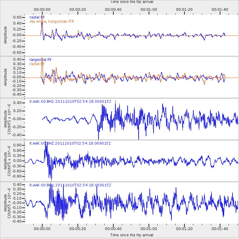
AAK Ala Archa, Kyrgyzstan - Earthquake Result Viewer
*The percent match for this event was below the threshold and hence no stack was calculated.
| Earthquake location: |
Near East Coast Of Honshu, Japan |
| Earthquake latitude/longitude: |
37.5/141.3 |
| Earthquake time(UTC): |
2011/10/10 (283) 02:45:57 GMT |
| Earthquake Depth: |
46 km |
| Earthquake Magnitude: |
5.6 MW, 5.7 MW |
| Earthquake Catalog/Contributor: |
NEIC PDE/NEIC PDE-M |
|
| Network: |
II Global Seismograph Network (GSN - IRIS/IDA) |
| Station: |
AAK Ala Archa, Kyrgyzstan |
| Lat/Lon: |
42.64 N/74.49 E |
| Elevation: |
1645 m |
|
| Distance: |
50.1 deg |
| Az: |
297.951 deg |
| Baz: |
72.083 deg |
| Ray Param: |
$rayparam |
*The percent match for this event was below the threshold and hence was not used in the summary stack. |
|
| Radial Match: |
66.7863 % |
| Radial Bump: |
400 |
| Transverse Match: |
59.784306 % |
| Transverse Bump: |
400 |
| SOD ConfigId: |
558545 |
| Insert Time: |
2013-09-19 04:09:30.328 +0000 |
| GWidth: |
2.5 |
| Max Bumps: |
400 |
| Tol: |
0.001 |
|
Signal To Noise
| Channel | StoN | STA | LTA |
| II:AAK:00:BHZ:20111010T02:54:18.069015Z | 10.863565 | 4.7972384E-7 | 4.4158966E-8 |
| II:AAK:00:BH1:20111010T02:54:18.069015Z | 2.9476943 | 1.6570118E-7 | 5.621383E-8 |
| II:AAK:00:BH2:20111010T02:54:18.069015Z | 5.0488515 | 1.893949E-7 | 3.751247E-8 |
| Arrivals |
| Ps | |
| PpPs | |
| PsPs/PpSs | |


