You are here: Home > Network List > IU - Global Seismograph Network (GSN - IRIS/USGS) Stations List
> Station GNI Garni, Armenia > Earthquake Result Viewer
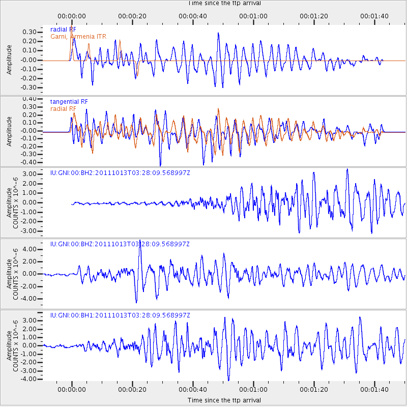
GNI Garni, Armenia - Earthquake Result Viewer
*The percent match for this event was below the threshold and hence no stack was calculated.
| Earthquake location: |
South Of Bali, Indonesia |
| Earthquake latitude/longitude: |
-9.4/114.6 |
| Earthquake time(UTC): |
2011/10/13 (286) 03:16:30 GMT |
| Earthquake Depth: |
39 km |
| Earthquake Magnitude: |
6.1 MB, 6.0 MS, 6.2 MW, 6.1 MW |
| Earthquake Catalog/Contributor: |
WHDF/NEIC |
|
| Network: |
IU Global Seismograph Network (GSN - IRIS/USGS) |
| Station: |
GNI Garni, Armenia |
| Lat/Lon: |
40.15 N/44.74 E |
| Elevation: |
1609 m |
|
| Distance: |
81.0 deg |
| Az: |
313.23 deg |
| Baz: |
110.267 deg |
| Ray Param: |
$rayparam |
*The percent match for this event was below the threshold and hence was not used in the summary stack. |
|
| Radial Match: |
76.085045 % |
| Radial Bump: |
400 |
| Transverse Match: |
77.88646 % |
| Transverse Bump: |
400 |
| SOD ConfigId: |
558545 |
| Insert Time: |
2013-09-19 04:15:46.154 +0000 |
| GWidth: |
2.5 |
| Max Bumps: |
400 |
| Tol: |
0.001 |
|
Signal To Noise
| Channel | StoN | STA | LTA |
| IU:GNI:00:BHZ:20111013T03:28:09.568997Z | 8.802079 | 6.0499076E-7 | 6.873272E-8 |
| IU:GNI:00:BH1:20111013T03:28:09.568997Z | 2.4300826 | 2.2258288E-7 | 9.159478E-8 |
| IU:GNI:00:BH2:20111013T03:28:09.568997Z | 1.9273041 | 1.3932116E-7 | 7.22881E-8 |
| Arrivals |
| Ps | |
| PpPs | |
| PsPs/PpSs | |


