You are here: Home > Network List > CU - Caribbean Network (USGS) Stations List
> Station GTBY Guantanamo Bay, Cuba > Earthquake Result Viewer
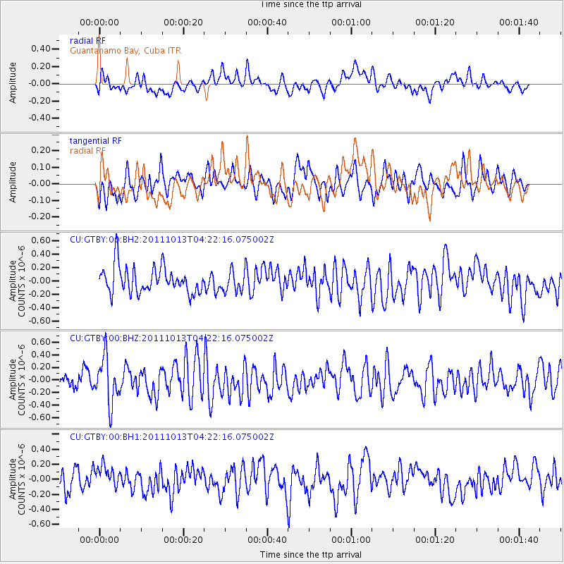
GTBY Guantanamo Bay, Cuba - Earthquake Result Viewer
*The percent match for this event was below the threshold and hence no stack was calculated.
| Earthquake location: |
Off Coast Of Oregon |
| Earthquake latitude/longitude: |
43.5/-127.1 |
| Earthquake time(UTC): |
2011/10/13 (286) 04:14:00 GMT |
| Earthquake Depth: |
21 km |
| Earthquake Magnitude: |
5.6 MW, 5.0 MS, 5.4 MB |
| Earthquake Catalog/Contributor: |
WHDF/NEIC |
|
| Network: |
CU Caribbean Network (USGS) |
| Station: |
GTBY Guantanamo Bay, Cuba |
| Lat/Lon: |
19.93 N/75.11 W |
| Elevation: |
79 m |
|
| Distance: |
49.2 deg |
| Az: |
101.444 deg |
| Baz: |
310.666 deg |
| Ray Param: |
$rayparam |
*The percent match for this event was below the threshold and hence was not used in the summary stack. |
|
| Radial Match: |
46.37202 % |
| Radial Bump: |
400 |
| Transverse Match: |
43.266514 % |
| Transverse Bump: |
400 |
| SOD ConfigId: |
558545 |
| Insert Time: |
2013-09-19 04:16:45.959 +0000 |
| GWidth: |
2.5 |
| Max Bumps: |
400 |
| Tol: |
0.001 |
|
Signal To Noise
| Channel | StoN | STA | LTA |
| CU:GTBY:00:BHZ:20111013T04:22:16.075002Z | 2.855186 | 3.777841E-7 | 1.3231505E-7 |
| CU:GTBY:00:BH1:20111013T04:22:16.075002Z | 0.8182698 | 1.5264568E-7 | 1.8654688E-7 |
| CU:GTBY:00:BH2:20111013T04:22:16.075002Z | 0.8056841 | 1.5961729E-7 | 1.98114E-7 |
| Arrivals |
| Ps | |
| PpPs | |
| PsPs/PpSs | |


