You are here: Home > Network List > US - United States National Seismic Network Stations List
> Station MIAR Mount Ida, Arkansas, USA > Earthquake Result Viewer
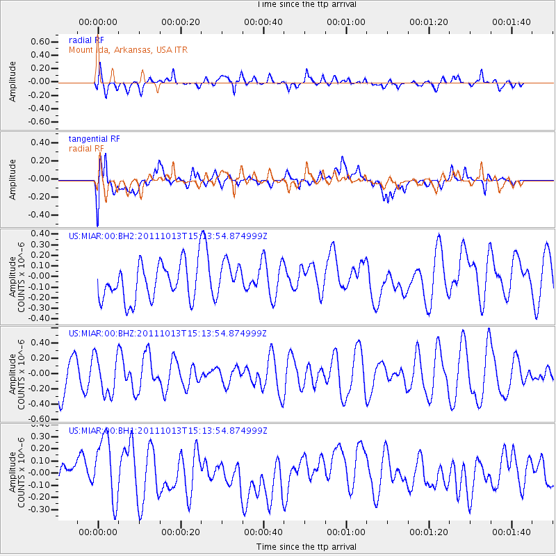
MIAR Mount Ida, Arkansas, USA - Earthquake Result Viewer
*The percent match for this event was below the threshold and hence no stack was calculated.
| Earthquake location: |
Northern Peru |
| Earthquake latitude/longitude: |
-6.6/-75.6 |
| Earthquake time(UTC): |
2011/10/13 (286) 15:06:15 GMT |
| Earthquake Depth: |
12 km |
| Earthquake Magnitude: |
5.5 ML |
| Earthquake Catalog/Contributor: |
NEIC PDE/NEIC PDE-M |
|
| Network: |
US United States National Seismic Network |
| Station: |
MIAR Mount Ida, Arkansas, USA |
| Lat/Lon: |
34.55 N/93.58 W |
| Elevation: |
207 m |
|
| Distance: |
44.3 deg |
| Az: |
338.562 deg |
| Baz: |
153.904 deg |
| Ray Param: |
$rayparam |
*The percent match for this event was below the threshold and hence was not used in the summary stack. |
|
| Radial Match: |
48.082638 % |
| Radial Bump: |
400 |
| Transverse Match: |
49.943985 % |
| Transverse Bump: |
400 |
| SOD ConfigId: |
558545 |
| Insert Time: |
2013-09-19 04:19:44.615 +0000 |
| GWidth: |
2.5 |
| Max Bumps: |
400 |
| Tol: |
0.001 |
|
Signal To Noise
| Channel | StoN | STA | LTA |
| US:MIAR:00:BHZ:20111013T15:13:54.874999Z | 1.2367518 | 2.527147E-7 | 2.0433745E-7 |
| US:MIAR:00:BH1:20111013T15:13:54.874999Z | 1.9623758 | 2.974191E-7 | 1.5156074E-7 |
| US:MIAR:00:BH2:20111013T15:13:54.874999Z | 0.93486285 | 1.6002222E-7 | 1.7117186E-7 |
| Arrivals |
| Ps | |
| PpPs | |
| PsPs/PpSs | |


