You are here: Home > Network List > CN - Canadian National Seismograph Network Stations List
> Station INK INUVIK, NT, CANADA.ANADA > Earthquake Result Viewer
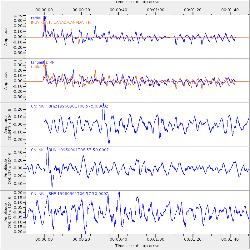
INK INUVIK, NT, CANADA.ANADA - Earthquake Result Viewer
*The percent match for this event was below the threshold and hence no stack was calculated.
| Earthquake location: |
Santa Cruz Islands |
| Earthquake latitude/longitude: |
-11.8/166.6 |
| Earthquake time(UTC): |
1996/09/01 (245) 06:45:41 GMT |
| Earthquake Depth: |
187 km |
| Earthquake Magnitude: |
5.5 MB, 5.9 UNKNOWN, 5.8 MW |
| Earthquake Catalog/Contributor: |
WHDF/NEIC |
|
| Network: |
CN Canadian National Seismograph Network |
| Station: |
INK INUVIK, NT, CANADA.ANADA |
| Lat/Lon: |
68.31 N/133.52 W |
| Elevation: |
40 m |
|
| Distance: |
90.3 deg |
| Az: |
18.756 deg |
| Baz: |
237.861 deg |
| Ray Param: |
$rayparam |
*The percent match for this event was below the threshold and hence was not used in the summary stack. |
|
| Radial Match: |
60.35304 % |
| Radial Bump: |
400 |
| Transverse Match: |
61.68615 % |
| Transverse Bump: |
400 |
| SOD ConfigId: |
4480 |
| Insert Time: |
2010-02-27 06:29:05.941 +0000 |
| GWidth: |
2.5 |
| Max Bumps: |
400 |
| Tol: |
0.001 |
|
Signal To Noise
| Channel | StoN | STA | LTA |
| CN:INK: :BHN:19960901T06:57:50.000Z | 3.9087462 | 2.494176E-7 | 6.381013E-8 |
| CN:INK: :BHE:19960901T06:57:50.000Z | 2.4466033 | 9.2681226E-8 | 3.788159E-8 |
| CN:INK: :BHZ:19960901T06:57:50.000Z | 1.8679584 | 1.2957531E-7 | 6.9367346E-8 |
| Arrivals |
| Ps | |
| PpPs | |
| PsPs/PpSs | |


