You are here: Home > Network List > II - Global Seismograph Network (GSN - IRIS/IDA) Stations List
> Station WRAB Tennant Creek, NT, Australia > Earthquake Result Viewer
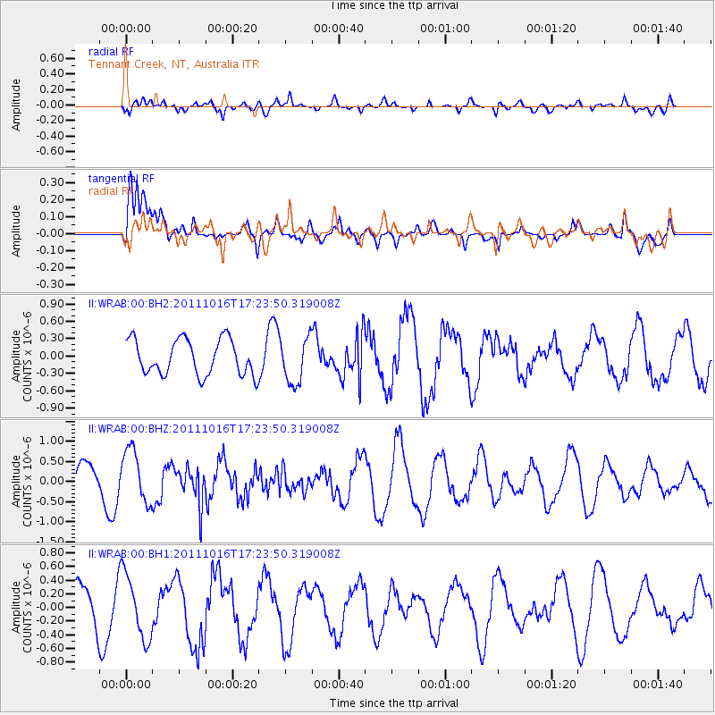
WRAB Tennant Creek, NT, Australia - Earthquake Result Viewer
*The percent match for this event was below the threshold and hence no stack was calculated.
| Earthquake location: |
Northern Sumatra, Indonesia |
| Earthquake latitude/longitude: |
2.4/96.2 |
| Earthquake time(UTC): |
2011/10/16 (289) 17:16:20 GMT |
| Earthquake Depth: |
35 km |
| Earthquake Magnitude: |
5.5 MB |
| Earthquake Catalog/Contributor: |
NEIC PDE/NEIC PDE-M |
|
| Network: |
II Global Seismograph Network (GSN - IRIS/IDA) |
| Station: |
WRAB Tennant Creek, NT, Australia |
| Lat/Lon: |
19.93 S/134.36 E |
| Elevation: |
366 m |
|
| Distance: |
43.6 deg |
| Az: |
122.465 deg |
| Baz: |
296.364 deg |
| Ray Param: |
$rayparam |
*The percent match for this event was below the threshold and hence was not used in the summary stack. |
|
| Radial Match: |
67.66991 % |
| Radial Bump: |
400 |
| Transverse Match: |
78.00996 % |
| Transverse Bump: |
400 |
| SOD ConfigId: |
558545 |
| Insert Time: |
2013-09-19 04:27:00.679 +0000 |
| GWidth: |
2.5 |
| Max Bumps: |
400 |
| Tol: |
0.001 |
|
Signal To Noise
| Channel | StoN | STA | LTA |
| II:WRAB:00:BHZ:20111016T17:23:50.319008Z | 1.459644 | 6.595884E-7 | 4.5188307E-7 |
| II:WRAB:00:BH1:20111016T17:23:50.319008Z | 1.9117383 | 4.704285E-7 | 2.4607368E-7 |
| II:WRAB:00:BH2:20111016T17:23:50.319008Z | 1.2931422 | 3.9464246E-7 | 3.0518103E-7 |
| Arrivals |
| Ps | |
| PpPs | |
| PsPs/PpSs | |


