You are here: Home > Network List > IU - Global Seismograph Network (GSN - IRIS/USGS) Stations List
> Station MAKZ Makanchi, Kazakhstan > Earthquake Result Viewer
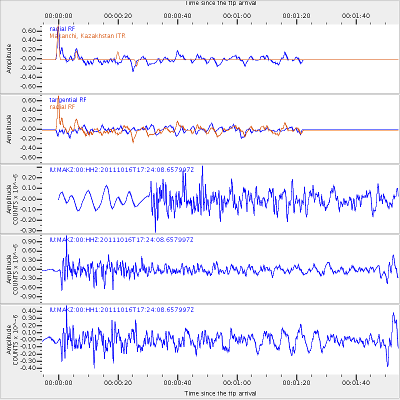
MAKZ Makanchi, Kazakhstan - Earthquake Result Viewer
*The percent match for this event was below the threshold and hence no stack was calculated.
| Earthquake location: |
Northern Sumatra, Indonesia |
| Earthquake latitude/longitude: |
2.4/96.2 |
| Earthquake time(UTC): |
2011/10/16 (289) 17:16:20 GMT |
| Earthquake Depth: |
35 km |
| Earthquake Magnitude: |
5.5 MB |
| Earthquake Catalog/Contributor: |
NEIC PDE/NEIC PDE-M |
|
| Network: |
IU Global Seismograph Network (GSN - IRIS/USGS) |
| Station: |
MAKZ Makanchi, Kazakhstan |
| Lat/Lon: |
46.81 N/81.98 E |
| Elevation: |
600 m |
|
| Distance: |
45.9 deg |
| Az: |
346.423 deg |
| Baz: |
160.035 deg |
| Ray Param: |
$rayparam |
*The percent match for this event was below the threshold and hence was not used in the summary stack. |
|
| Radial Match: |
72.13173 % |
| Radial Bump: |
400 |
| Transverse Match: |
55.6802 % |
| Transverse Bump: |
400 |
| SOD ConfigId: |
558545 |
| Insert Time: |
2013-09-19 04:27:20.207 +0000 |
| GWidth: |
2.5 |
| Max Bumps: |
400 |
| Tol: |
0.001 |
|
Signal To Noise
| Channel | StoN | STA | LTA |
| IU:MAKZ:00:HHZ:20111016T17:24:08.657997Z | 5.7236743 | 2.9662317E-7 | 5.1823907E-8 |
| IU:MAKZ:00:HH1:20111016T17:24:08.657997Z | 2.8181918 | 1.3608381E-7 | 4.828763E-8 |
| IU:MAKZ:00:HH2:20111016T17:24:08.657997Z | 1.6784064 | 9.783444E-8 | 5.8290077E-8 |
| Arrivals |
| Ps | |
| PpPs | |
| PsPs/PpSs | |


