You are here: Home > Network List > US - United States National Seismic Network Stations List
> Station HAWA Hanford, Washington, USA > Earthquake Result Viewer
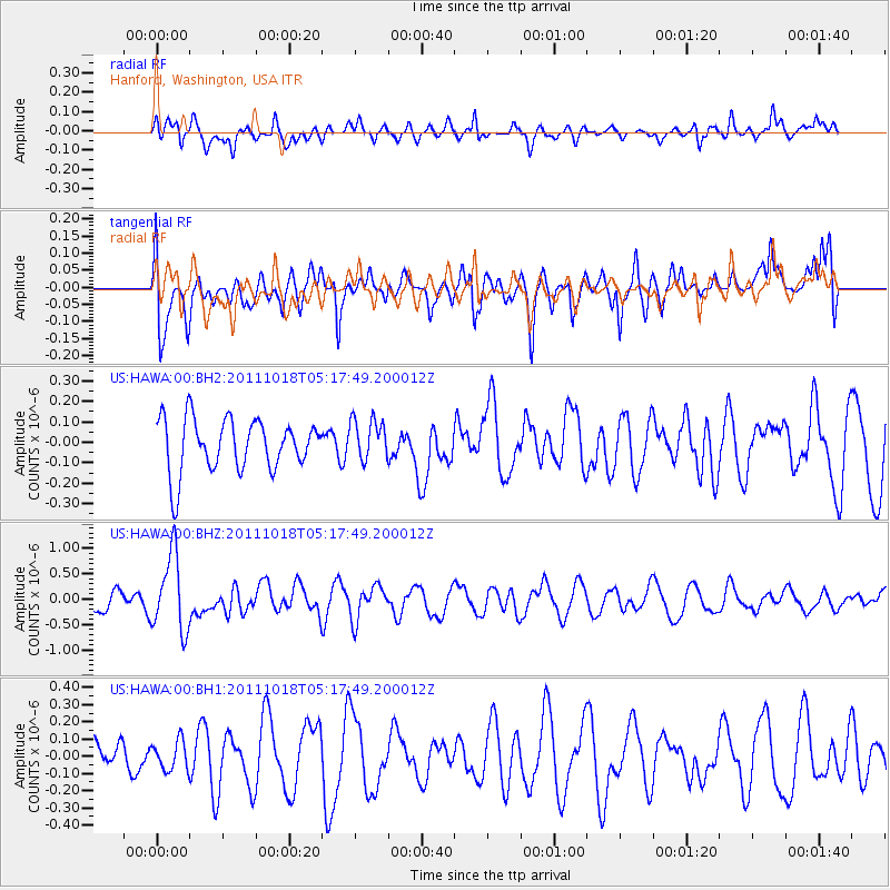
HAWA Hanford, Washington, USA - Earthquake Result Viewer
*The percent match for this event was below the threshold and hence no stack was calculated.
| Earthquake location: |
New Britain Region, P.N.G. |
| Earthquake latitude/longitude: |
-5.8/151.0 |
| Earthquake time(UTC): |
2011/10/18 (291) 05:05:06 GMT |
| Earthquake Depth: |
26 km |
| Earthquake Magnitude: |
5.5 MB, 5.9 MS, 6.0 MW, 6.1 MW |
| Earthquake Catalog/Contributor: |
WHDF/NEIC |
|
| Network: |
US United States National Seismic Network |
| Station: |
HAWA Hanford, Washington, USA |
| Lat/Lon: |
46.39 N/119.53 W |
| Elevation: |
364 m |
|
| Distance: |
93.8 deg |
| Az: |
43.915 deg |
| Baz: |
265.606 deg |
| Ray Param: |
$rayparam |
*The percent match for this event was below the threshold and hence was not used in the summary stack. |
|
| Radial Match: |
63.135796 % |
| Radial Bump: |
400 |
| Transverse Match: |
58.9715 % |
| Transverse Bump: |
400 |
| SOD ConfigId: |
558545 |
| Insert Time: |
2013-09-19 04:29:19.752 +0000 |
| GWidth: |
2.5 |
| Max Bumps: |
400 |
| Tol: |
0.001 |
|
Signal To Noise
| Channel | StoN | STA | LTA |
| US:HAWA:00:BHZ:20111018T05:17:49.200012Z | 4.744395 | 7.5158897E-7 | 1.5841619E-7 |
| US:HAWA:00:BH1:20111018T05:17:49.200012Z | 0.72772455 | 8.3604164E-8 | 1.1488435E-7 |
| US:HAWA:00:BH2:20111018T05:17:49.200012Z | 0.7920684 | 1.013169E-7 | 1.2791433E-7 |
| Arrivals |
| Ps | |
| PpPs | |
| PsPs/PpSs | |


