You are here: Home > Network List > IU - Global Seismograph Network (GSN - IRIS/USGS) Stations List
> Station HNR Honiara, Solomon Islands > Earthquake Result Viewer
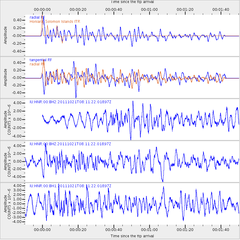
HNR Honiara, Solomon Islands - Earthquake Result Viewer
*The percent match for this event was below the threshold and hence no stack was calculated.
| Earthquake location: |
Hokkaido, Japan Region |
| Earthquake latitude/longitude: |
43.9/142.5 |
| Earthquake time(UTC): |
2011/10/21 (294) 08:02:37 GMT |
| Earthquake Depth: |
187 km |
| Earthquake Magnitude: |
5.9 MB, 6.1 MW, 6.1 MW |
| Earthquake Catalog/Contributor: |
WHDF/NEIC |
|
| Network: |
IU Global Seismograph Network (GSN - IRIS/USGS) |
| Station: |
HNR Honiara, Solomon Islands |
| Lat/Lon: |
9.44 S/159.95 E |
| Elevation: |
100 m |
|
| Distance: |
55.4 deg |
| Az: |
158.911 deg |
| Baz: |
344.713 deg |
| Ray Param: |
$rayparam |
*The percent match for this event was below the threshold and hence was not used in the summary stack. |
|
| Radial Match: |
59.503872 % |
| Radial Bump: |
400 |
| Transverse Match: |
69.427826 % |
| Transverse Bump: |
400 |
| SOD ConfigId: |
558545 |
| Insert Time: |
2013-09-19 04:34:26.940 +0000 |
| GWidth: |
2.5 |
| Max Bumps: |
400 |
| Tol: |
0.001 |
|
Signal To Noise
| Channel | StoN | STA | LTA |
| IU:HNR:00:BHZ:20111021T08:11:22.01897Z | 3.2243383 | 2.2069817E-6 | 6.844759E-7 |
| IU:HNR:00:BH1:20111021T08:11:22.01897Z | 1.5984639 | 1.6452261E-6 | 1.0292545E-6 |
| IU:HNR:00:BH2:20111021T08:11:22.01897Z | 1.1726972 | 1.031057E-6 | 8.792184E-7 |
| Arrivals |
| Ps | |
| PpPs | |
| PsPs/PpSs | |


