You are here: Home > Network List > CN - Canadian National Seismograph Network Stations List
> Station INK INUVIK, NT, CANADA.ANADA > Earthquake Result Viewer
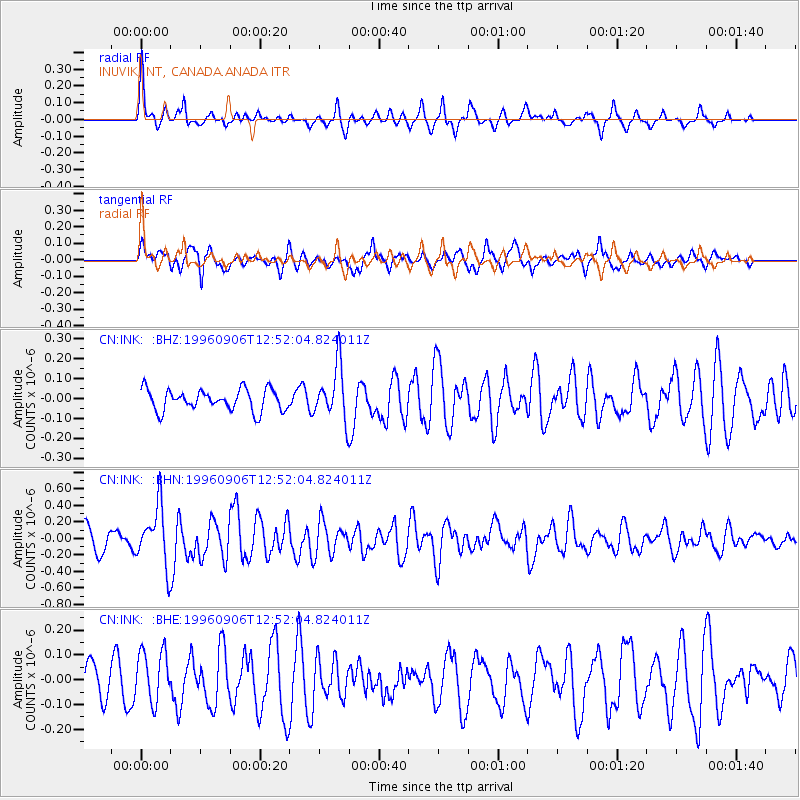
INK INUVIK, NT, CANADA.ANADA - Earthquake Result Viewer
*The percent match for this event was below the threshold and hence no stack was calculated.
| Earthquake location: |
Solomon Islands |
| Earthquake latitude/longitude: |
-7.3/155.8 |
| Earthquake time(UTC): |
1996/09/06 (250) 12:39:41 GMT |
| Earthquake Depth: |
33 km |
| Earthquake Magnitude: |
5.5 MB, 5.8 MS, 5.9 UNKNOWN, 5.9 MW |
| Earthquake Catalog/Contributor: |
WHDF/NEIC |
|
| Network: |
CN Canadian National Seismograph Network |
| Station: |
INK INUVIK, NT, CANADA.ANADA |
| Lat/Lon: |
68.31 N/133.52 W |
| Elevation: |
40 m |
|
| Distance: |
89.7 deg |
| Az: |
20.536 deg |
| Baz: |
249.402 deg |
| Ray Param: |
$rayparam |
*The percent match for this event was below the threshold and hence was not used in the summary stack. |
|
| Radial Match: |
65.460754 % |
| Radial Bump: |
278 |
| Transverse Match: |
66.09573 % |
| Transverse Bump: |
400 |
| SOD ConfigId: |
4480 |
| Insert Time: |
2010-02-27 06:29:43.019 +0000 |
| GWidth: |
2.5 |
| Max Bumps: |
400 |
| Tol: |
0.001 |
|
Signal To Noise
| Channel | StoN | STA | LTA |
| CN:INK: :BHN:19960906T12:52:04.824011Z | 2.925091 | 3.5269778E-7 | 1.2057669E-7 |
| CN:INK: :BHE:19960906T12:52:04.824011Z | 1.4503603 | 1.0502069E-7 | 7.2410074E-8 |
| CN:INK: :BHZ:19960906T12:52:04.824011Z | 2.5788999 | 1.3529413E-7 | 5.2461957E-8 |
| Arrivals |
| Ps | |
| PpPs | |
| PsPs/PpSs | |


