You are here: Home > Network List > US - United States National Seismic Network Stations List
> Station OGNE Ogallala, Nebraska, USA > Earthquake Result Viewer
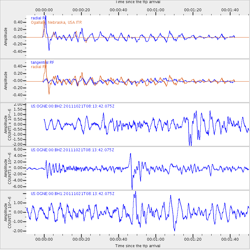
OGNE Ogallala, Nebraska, USA - Earthquake Result Viewer
*The percent match for this event was below the threshold and hence no stack was calculated.
| Earthquake location: |
Hokkaido, Japan Region |
| Earthquake latitude/longitude: |
43.9/142.5 |
| Earthquake time(UTC): |
2011/10/21 (294) 08:02:37 GMT |
| Earthquake Depth: |
187 km |
| Earthquake Magnitude: |
5.9 MB, 6.1 MW, 6.1 MW |
| Earthquake Catalog/Contributor: |
WHDF/NEIC |
|
| Network: |
US United States National Seismic Network |
| Station: |
OGNE Ogallala, Nebraska, USA |
| Lat/Lon: |
40.95 N/102.03 W |
| Elevation: |
0.0 m |
|
| Distance: |
77.6 deg |
| Az: |
44.444 deg |
| Baz: |
318.065 deg |
| Ray Param: |
$rayparam |
*The percent match for this event was below the threshold and hence was not used in the summary stack. |
|
| Radial Match: |
75.820145 % |
| Radial Bump: |
365 |
| Transverse Match: |
62.247116 % |
| Transverse Bump: |
400 |
| SOD ConfigId: |
558545 |
| Insert Time: |
2013-09-19 04:37:17.336 +0000 |
| GWidth: |
2.5 |
| Max Bumps: |
400 |
| Tol: |
0.001 |
|
Signal To Noise
| Channel | StoN | STA | LTA |
| US:OGNE:00:BHZ:20111021T08:13:42.075Z | 7.6916785 | 1.279894E-6 | 1.6639984E-7 |
| US:OGNE:00:BH1:20111021T08:13:42.075Z | 1.2891865 | 5.128749E-7 | 3.978283E-7 |
| US:OGNE:00:BH2:20111021T08:13:42.075Z | 1.4579378 | 5.4921725E-7 | 3.7670827E-7 |
| Arrivals |
| Ps | |
| PpPs | |
| PsPs/PpSs | |


