QSPA South Pole Remote Earth Science Observatory (Quiet Zone) - Earthquake Result Viewer
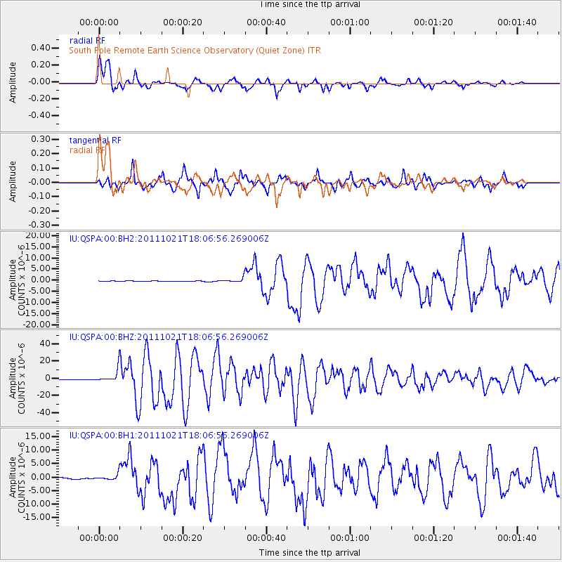
Earthquake location: Kermadec Islands Region
Earthquake latitude/longitude: -29.0/-176.2
Earthquake time(UTC): 2011/10/21 (294) 17:57:16 GMT
Earthquake Depth: 33 km
Earthquake Magnitude: 6.4 MB, 7.5 MS, 7.4 MW, 7.4 MW
Earthquake Catalog/Contributor: WHDF/NEIC
Network: IU Global Seismograph Network (GSN - IRIS/USGS)
Station: QSPA South Pole Remote Earth Science Observatory (Quiet Zone)
Lat/Lon: 89.93 S/144.44 E
Elevation: 2850 m
Distance: 61.1 deg
Az: 180.052 deg
Baz: 39.349 deg
Ray Param: 0.061028797
Estimated Moho Depth: 21.25 km
Estimated Crust Vp/Vs: 1.60
Assumed Crust Vp: 6.193 km/s
Estimated Crust Vs: 3.871 km/s
Estimated Crust Poisson's Ratio: 0.18
Radial Match: 95.02344 %
Radial Bump: 400
Transverse Match: 95.70902 %
Transverse Bump: 400
SOD ConfigId: 558545
Insert Time: 2013-09-19 04:40:05.949 +0000
GWidth: 2.5
Max Bumps: 400
Tol: 0.001

Signal To Noise

ChannelStoNSTALTA
IU:QSPA:00:BHZ:20111021T18:06:56.269006Z38.9076047.780304E-61.9996872E-7
IU:QSPA:00:BH1:20111021T18:06:56.269006Z4.66155341.1082882E-62.3775084E-7
IU:QSPA:00:BH2:20111021T18:06:56.269006Z9.2874631.0909782E-61.17467835E-7
Arrivals
Ps2.2 SECOND
PpPs8.5 SECOND
PsPs/PpSs11 SECOND