You are here: Home > Network List > CN - Canadian National Seismograph Network Stations List
> Station INK INUVIK, NT, CANADA.ANADA > Earthquake Result Viewer
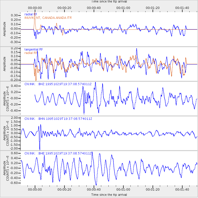
INK INUVIK, NT, CANADA.ANADA - Earthquake Result Viewer
*The percent match for this event was below the threshold and hence no stack was calculated.
| Earthquake location: |
Northern Molucca Sea |
| Earthquake latitude/longitude: |
0.8/126.0 |
| Earthquake time(UTC): |
1995/10/29 (302) 19:24:29 GMT |
| Earthquake Depth: |
33 km |
| Earthquake Magnitude: |
6.1 MB, 5.4 MS |
| Earthquake Catalog/Contributor: |
WHDF/NEIC |
|
| Network: |
CN Canadian National Seismograph Network |
| Station: |
INK INUVIK, NT, CANADA.ANADA |
| Lat/Lon: |
68.31 N/133.52 W |
| Elevation: |
40 m |
|
| Distance: |
93.1 deg |
| Az: |
21.475 deg |
| Baz: |
280.073 deg |
| Ray Param: |
$rayparam |
*The percent match for this event was below the threshold and hence was not used in the summary stack. |
|
| Radial Match: |
38.962887 % |
| Radial Bump: |
400 |
| Transverse Match: |
56.814857 % |
| Transverse Bump: |
400 |
| SOD ConfigId: |
4480 |
| Insert Time: |
2010-02-27 06:29:55.378 +0000 |
| GWidth: |
2.5 |
| Max Bumps: |
400 |
| Tol: |
0.001 |
|
Signal To Noise
| Channel | StoN | STA | LTA |
| CN:INK: :BHN:19951029T19:37:08.574011Z | 2.7425897 | 6.926141E-7 | 2.525402E-7 |
| CN:INK: :BHE:19951029T19:37:08.574011Z | 1.6226444 | 2.565936E-7 | 1.5813298E-7 |
| CN:INK: :BHZ:19951029T19:37:08.574011Z | 1.8579451 | 2.1843904E-7 | 1.1757024E-7 |
| Arrivals |
| Ps | |
| PpPs | |
| PsPs/PpSs | |


