You are here: Home > Network List > CN - Canadian National Seismograph Network Stations List
> Station INK INUVIK, NT, CANADA.ANADA > Earthquake Result Viewer
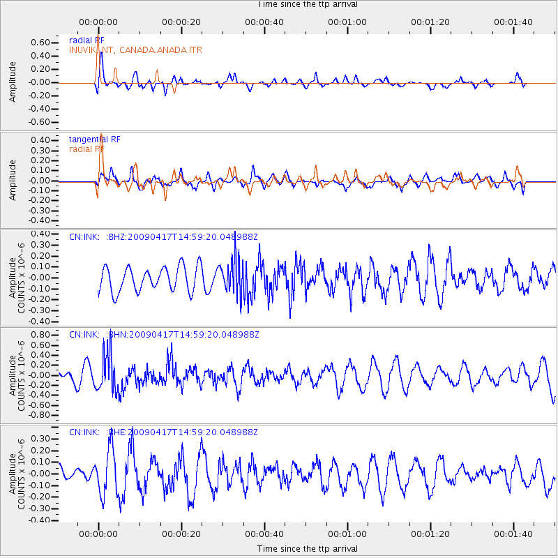
INK INUVIK, NT, CANADA.ANADA - Earthquake Result Viewer
*The percent match for this event was below the threshold and hence no stack was calculated.
| Earthquake location: |
Kuril Islands |
| Earthquake latitude/longitude: |
46.2/151.7 |
| Earthquake time(UTC): |
2009/04/17 (107) 14:51:58 GMT |
| Earthquake Depth: |
49 km |
| Earthquake Magnitude: |
5.5 MB, 5.0 MS, 5.7 MW, 5.6 MW |
| Earthquake Catalog/Contributor: |
WHDF/NEIC |
|
| Network: |
CN Canadian National Seismograph Network |
| Station: |
INK INUVIK, NT, CANADA.ANADA |
| Lat/Lon: |
68.31 N/133.52 W |
| Elevation: |
40 m |
|
| Distance: |
42.7 deg |
| Az: |
31.962 deg |
| Baz: |
278.308 deg |
| Ray Param: |
$rayparam |
*The percent match for this event was below the threshold and hence was not used in the summary stack. |
|
| Radial Match: |
60.02651 % |
| Radial Bump: |
400 |
| Transverse Match: |
48.90179 % |
| Transverse Bump: |
400 |
| SOD ConfigId: |
2760 |
| Insert Time: |
2010-02-27 06:30:09.146 +0000 |
| GWidth: |
2.5 |
| Max Bumps: |
400 |
| Tol: |
0.001 |
|
Signal To Noise
| Channel | StoN | STA | LTA |
| CN:INK: :BHN:20090417T14:59:20.048988Z | 3.1848545 | 3.6926386E-7 | 1.15943706E-7 |
| CN:INK: :BHE:20090417T14:59:20.048988Z | 3.0105786 | 1.9658462E-7 | 6.5297954E-8 |
| CN:INK: :BHZ:20090417T14:59:20.048988Z | 1.4209305 | 1.5634343E-7 | 1.100289E-7 |
| Arrivals |
| Ps | |
| PpPs | |
| PsPs/PpSs | |


