You are here: Home > Network List > US - United States National Seismic Network Stations List
> Station DGMT Dagmar, Montana, USA > Earthquake Result Viewer
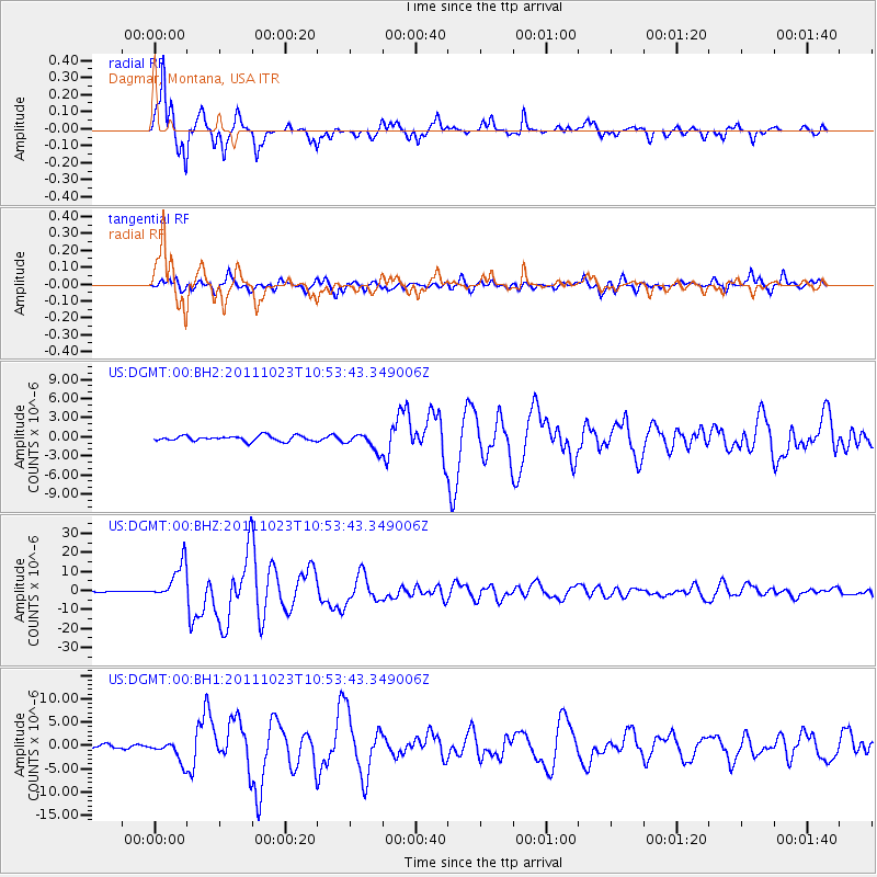
DGMT Dagmar, Montana, USA - Earthquake Result Viewer
*The percent match for this event was below the threshold and hence no stack was calculated.
| Earthquake location: |
Turkey |
| Earthquake latitude/longitude: |
38.7/43.5 |
| Earthquake time(UTC): |
2011/10/23 (296) 10:41:22 GMT |
| Earthquake Depth: |
16 km |
| Earthquake Magnitude: |
6.9 MB, 7.3 MS, 7.3 MW, 7.1 MW |
| Earthquake Catalog/Contributor: |
WHDF/NEIC |
|
| Network: |
US United States National Seismic Network |
| Station: |
DGMT Dagmar, Montana, USA |
| Lat/Lon: |
48.47 N/104.20 W |
| Elevation: |
0.0 m |
|
| Distance: |
88.6 deg |
| Az: |
339.167 deg |
| Baz: |
24.71 deg |
| Ray Param: |
$rayparam |
*The percent match for this event was below the threshold and hence was not used in the summary stack. |
|
| Radial Match: |
97.83789 % |
| Radial Bump: |
311 |
| Transverse Match: |
91.62973 % |
| Transverse Bump: |
400 |
| SOD ConfigId: |
558545 |
| Insert Time: |
2013-09-19 04:45:02.582 +0000 |
| GWidth: |
2.5 |
| Max Bumps: |
400 |
| Tol: |
0.001 |
|
Signal To Noise
| Channel | StoN | STA | LTA |
| US:DGMT:00:BHZ:20111023T10:53:43.349006Z | 61.81896 | 9.659254E-6 | 1.5625068E-7 |
| US:DGMT:00:BH1:20111023T10:53:43.349006Z | 4.255097 | 2.212145E-6 | 5.198812E-7 |
| US:DGMT:00:BH2:20111023T10:53:43.349006Z | 3.1529255 | 1.3186957E-6 | 4.1824515E-7 |
| Arrivals |
| Ps | |
| PpPs | |
| PsPs/PpSs | |


