You are here: Home > Network List > CN - Canadian National Seismograph Network Stations List
> Station INK INUVIK, NT, CANADA.ANADA > Earthquake Result Viewer
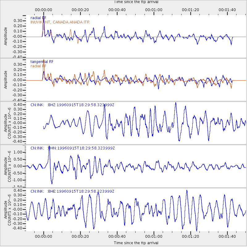
INK INUVIK, NT, CANADA.ANADA - Earthquake Result Viewer
*The percent match for this event was below the threshold and hence no stack was calculated.
| Earthquake location: |
Solomon Islands |
| Earthquake latitude/longitude: |
-6.5/154.8 |
| Earthquake time(UTC): |
1996/09/15 (259) 18:17:38 GMT |
| Earthquake Depth: |
50 km |
| Earthquake Magnitude: |
5.7 MB, 5.8 MS, 5.9 UNKNOWN, 5.9 MW |
| Earthquake Catalog/Contributor: |
WHDF/NEIC |
|
| Network: |
CN Canadian National Seismograph Network |
| Station: |
INK INUVIK, NT, CANADA.ANADA |
| Lat/Lon: |
68.31 N/133.52 W |
| Elevation: |
40 m |
|
| Distance: |
89.3 deg |
| Az: |
20.669 deg |
| Baz: |
250.629 deg |
| Ray Param: |
$rayparam |
*The percent match for this event was below the threshold and hence was not used in the summary stack. |
|
| Radial Match: |
70.41949 % |
| Radial Bump: |
400 |
| Transverse Match: |
56.529297 % |
| Transverse Bump: |
400 |
| SOD ConfigId: |
4480 |
| Insert Time: |
2010-02-27 06:30:14.822 +0000 |
| GWidth: |
2.5 |
| Max Bumps: |
400 |
| Tol: |
0.001 |
|
Signal To Noise
| Channel | StoN | STA | LTA |
| CN:INK: :BHN:19960915T18:29:58.323999Z | 7.597853 | 6.6087125E-7 | 8.698131E-8 |
| CN:INK: :BHE:19960915T18:29:58.323999Z | 0.98391366 | 1.3871144E-7 | 1.4097928E-7 |
| CN:INK: :BHZ:19960915T18:29:58.323999Z | 1.8832314 | 1.917596E-7 | 1.0182477E-7 |
| Arrivals |
| Ps | |
| PpPs | |
| PsPs/PpSs | |


