You are here: Home > Network List > CN - Canadian National Seismograph Network Stations List
> Station INK INUVIK, NT, CANADA.ANADA > Earthquake Result Viewer
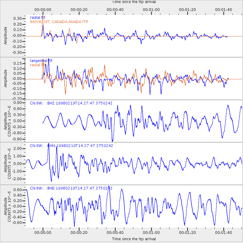
INK INUVIK, NT, CANADA.ANADA - Earthquake Result Viewer
*The percent match for this event was below the threshold and hence no stack was calculated.
| Earthquake location: |
Banda Sea |
| Earthquake latitude/longitude: |
-4.5/129.1 |
| Earthquake time(UTC): |
1998/02/19 (050) 14:14:51 GMT |
| Earthquake Depth: |
33 km |
| Earthquake Magnitude: |
6.1 MB, 6.4 MS, 6.5 UNKNOWN, 6.5 MW |
| Earthquake Catalog/Contributor: |
WHDF/NEIC |
|
| Network: |
CN Canadian National Seismograph Network |
| Station: |
INK INUVIK, NT, CANADA.ANADA |
| Lat/Lon: |
68.31 N/133.52 W |
| Elevation: |
40 m |
|
| Distance: |
96.9 deg |
| Az: |
21.8 deg |
| Baz: |
275.221 deg |
| Ray Param: |
$rayparam |
*The percent match for this event was below the threshold and hence was not used in the summary stack. |
|
| Radial Match: |
64.05054 % |
| Radial Bump: |
400 |
| Transverse Match: |
65.38496 % |
| Transverse Bump: |
379 |
| SOD ConfigId: |
4480 |
| Insert Time: |
2010-02-27 06:30:31.129 +0000 |
| GWidth: |
2.5 |
| Max Bumps: |
400 |
| Tol: |
0.001 |
|
Signal To Noise
| Channel | StoN | STA | LTA |
| CN:INK: :BHN:19980219T14:27:47.375024Z | 2.9727604 | 1.1219288E-6 | 3.77403E-7 |
| CN:INK: :BHE:19980219T14:27:47.375024Z | 0.49021485 | 1.69563E-7 | 3.4589527E-7 |
| CN:INK: :BHZ:19980219T14:27:47.375024Z | 0.98206514 | 2.0343754E-7 | 2.071528E-7 |
| Arrivals |
| Ps | |
| PpPs | |
| PsPs/PpSs | |


