You are here: Home > Network List > US - United States National Seismic Network Stations List
> Station EGMT Eagleton, Montana, USA > Earthquake Result Viewer
EGMT Eagleton, Montana, USA - Earthquake Result Viewer
*The percent match for this event was below the threshold and hence no stack was calculated.
| Earthquake location: |
Turkey |
| Earthquake latitude/longitude: |
38.6/43.1 |
| Earthquake time(UTC): |
2011/10/23 (296) 20:45:34 GMT |
| Earthquake Depth: |
5.0 km |
| Earthquake Magnitude: |
6.0 MB, 5.6 MS, 6.0 MW, 5.9 MW |
| Earthquake Catalog/Contributor: |
WHDF/NEIC |
|
| Network: |
US United States National Seismic Network |
| Station: |
EGMT Eagleton, Montana, USA |
| Lat/Lon: |
48.02 N/109.75 W |
| Elevation: |
1055 m |
|
| Distance: |
90.4 deg |
| Az: |
342.15 deg |
| Baz: |
20.954 deg |
| Ray Param: |
$rayparam |
*The percent match for this event was below the threshold and hence was not used in the summary stack. |
|
| Radial Match: |
49.44573 % |
| Radial Bump: |
400 |
| Transverse Match: |
48.507275 % |
| Transverse Bump: |
400 |
| SOD ConfigId: |
558545 |
| Insert Time: |
2013-09-19 04:56:13.950 +0000 |
| GWidth: |
2.5 |
| Max Bumps: |
400 |
| Tol: |
0.001 |
|
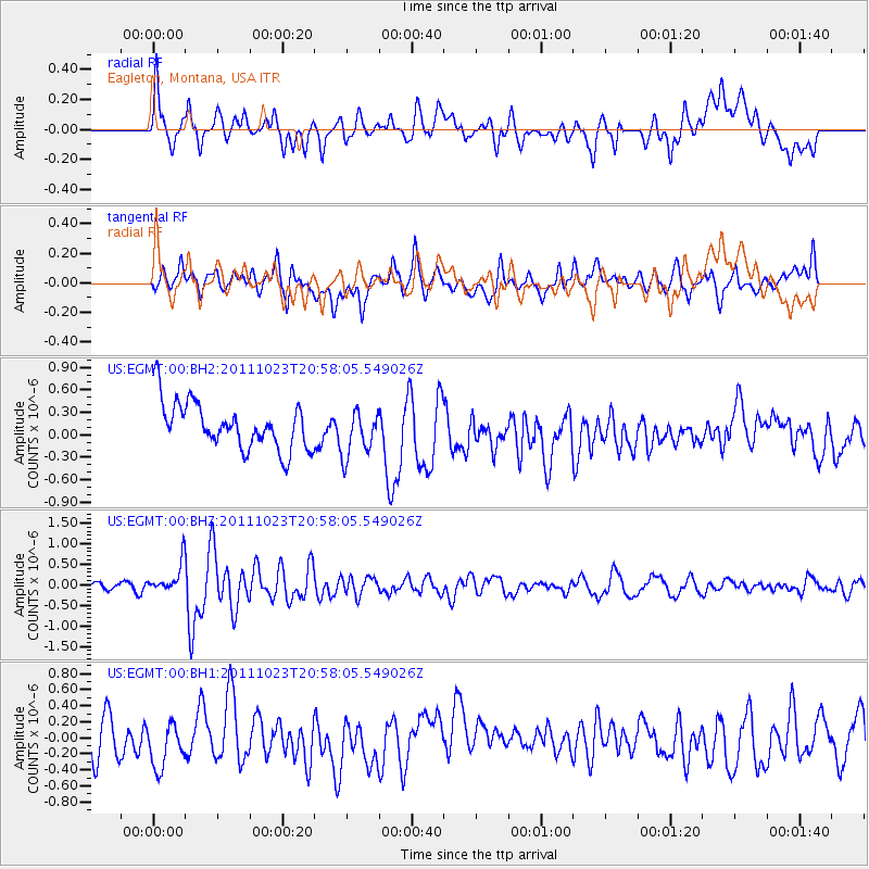
Signal To Noise
| Channel | StoN | STA | LTA |
| US:EGMT:00:BHZ:20111023T20:58:05.549026Z | 3.4776566 | 3.7090237E-7 | 1.0665296E-7 |
| US:EGMT:00:BH1:20111023T20:58:05.549026Z | 0.9003267 | 2.6400397E-7 | 2.932313E-7 |
| US:EGMT:00:BH2:20111023T20:58:05.549026Z | 0.9966722 | 3.1021563E-7 | 3.1125143E-7 |
| Arrivals |
| Ps | |
| PpPs | |
| PsPs/PpSs | |


