You are here: Home > Network List > US - United States National Seismic Network Stations List
> Station MIAR Mount Ida, Arkansas, USA > Earthquake Result Viewer
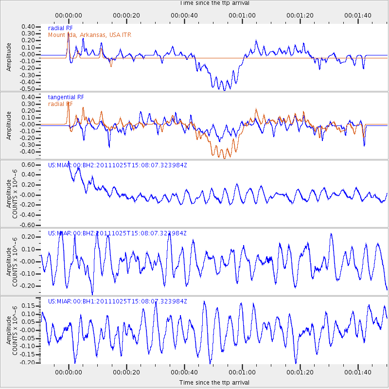
MIAR Mount Ida, Arkansas, USA - Earthquake Result Viewer
*The percent match for this event was below the threshold and hence no stack was calculated.
| Earthquake location: |
Turkey |
| Earthquake latitude/longitude: |
38.8/43.6 |
| Earthquake time(UTC): |
2011/10/25 (298) 14:55:08 GMT |
| Earthquake Depth: |
14 km |
| Earthquake Magnitude: |
5.7 MB, 5.2 MS, 5.6 MW, 5.3 MW |
| Earthquake Catalog/Contributor: |
WHDF/NEIC |
|
| Network: |
US United States National Seismic Network |
| Station: |
MIAR Mount Ida, Arkansas, USA |
| Lat/Lon: |
34.55 N/93.58 W |
| Elevation: |
207 m |
|
| Distance: |
96.9 deg |
| Az: |
325.598 deg |
| Baz: |
32.327 deg |
| Ray Param: |
$rayparam |
*The percent match for this event was below the threshold and hence was not used in the summary stack. |
|
| Radial Match: |
19.543032 % |
| Radial Bump: |
400 |
| Transverse Match: |
50.499474 % |
| Transverse Bump: |
400 |
| SOD ConfigId: |
558545 |
| Insert Time: |
2013-09-19 05:05:37.231 +0000 |
| GWidth: |
2.5 |
| Max Bumps: |
400 |
| Tol: |
0.001 |
|
Signal To Noise
| Channel | StoN | STA | LTA |
| US:MIAR:00:BHZ:20111025T15:08:07.323984Z | 1.2625186 | 1.0836789E-7 | 8.5834685E-8 |
| US:MIAR:00:BH1:20111025T15:08:07.323984Z | 1.384372 | 1.5751172E-7 | 1.1377847E-7 |
| US:MIAR:00:BH2:20111025T15:08:07.323984Z | 1.2364227 | 2.2133992E-7 | 1.7901638E-7 |
| Arrivals |
| Ps | |
| PpPs | |
| PsPs/PpSs | |


