You are here: Home > Network List > US - United States National Seismic Network Stations List
> Station MSO Missoula, Montana, USA > Earthquake Result Viewer
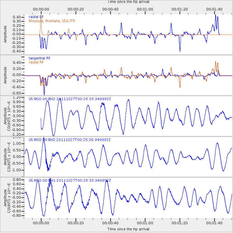
MSO Missoula, Montana, USA - Earthquake Result Viewer
*The percent match for this event was below the threshold and hence no stack was calculated.
| Earthquake location: |
Fiji Islands Region |
| Earthquake latitude/longitude: |
-17.9/-179.5 |
| Earthquake time(UTC): |
2011/10/27 (300) 00:15:24 GMT |
| Earthquake Depth: |
603 km |
| Earthquake Magnitude: |
6.0 MW, 5.3 MB, 6.0 MW |
| Earthquake Catalog/Contributor: |
WHDF/NEIC |
|
| Network: |
US United States National Seismic Network |
| Station: |
MSO Missoula, Montana, USA |
| Lat/Lon: |
46.83 N/113.94 W |
| Elevation: |
1264 m |
|
| Distance: |
87.3 deg |
| Az: |
38.752 deg |
| Baz: |
240.212 deg |
| Ray Param: |
$rayparam |
*The percent match for this event was below the threshold and hence was not used in the summary stack. |
|
| Radial Match: |
47.521034 % |
| Radial Bump: |
367 |
| Transverse Match: |
70.97675 % |
| Transverse Bump: |
393 |
| SOD ConfigId: |
558545 |
| Insert Time: |
2013-09-19 05:07:59.346 +0000 |
| GWidth: |
2.5 |
| Max Bumps: |
400 |
| Tol: |
0.001 |
|
Signal To Noise
| Channel | StoN | STA | LTA |
| US:MSO:00:BHZ:20111027T00:26:36.949993Z | 2.3518374 | 8.374705E-7 | 3.5609202E-7 |
| US:MSO:00:BH1:20111027T00:26:36.949993Z | 1.7425525 | 5.029248E-7 | 2.8861388E-7 |
| US:MSO:00:BH2:20111027T00:26:36.949993Z | 0.75627935 | 4.9326235E-7 | 6.5222235E-7 |
| Arrivals |
| Ps | |
| PpPs | |
| PsPs/PpSs | |


