You are here: Home > Network List > US - United States National Seismic Network Stations List
> Station VBMS Vicksburg, Mississippi > Earthquake Result Viewer
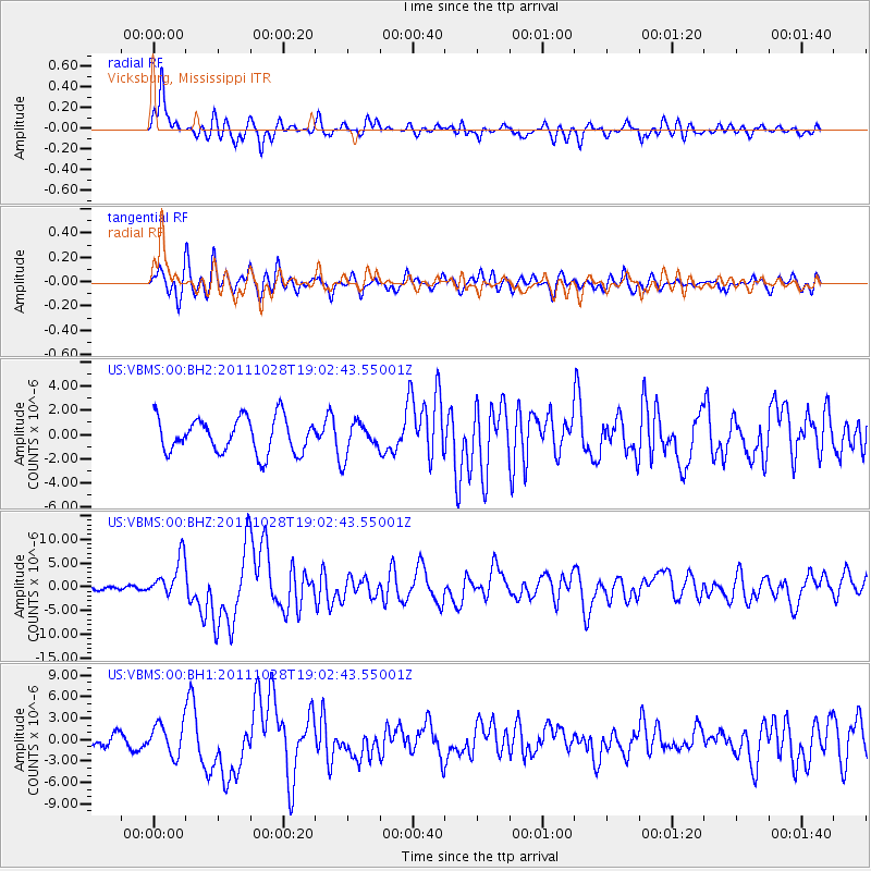
VBMS Vicksburg, Mississippi - Earthquake Result Viewer
*The percent match for this event was below the threshold and hence no stack was calculated.
| Earthquake location: |
Near Coast Of Peru |
| Earthquake latitude/longitude: |
-14.4/-76.0 |
| Earthquake time(UTC): |
2011/10/28 (301) 18:54:34 GMT |
| Earthquake Depth: |
24 km |
| Earthquake Magnitude: |
6.5 MB, 6.9 MS, 6.9 MW, 6.9 MW |
| Earthquake Catalog/Contributor: |
WHDF/NEIC |
|
| Network: |
US United States National Seismic Network |
| Station: |
VBMS Vicksburg, Mississippi |
| Lat/Lon: |
32.22 N/90.52 W |
| Elevation: |
0.0 m |
|
| Distance: |
48.4 deg |
| Az: |
343.464 deg |
| Baz: |
161.016 deg |
| Ray Param: |
$rayparam |
*The percent match for this event was below the threshold and hence was not used in the summary stack. |
|
| Radial Match: |
81.900635 % |
| Radial Bump: |
400 |
| Transverse Match: |
65.892395 % |
| Transverse Bump: |
400 |
| SOD ConfigId: |
558545 |
| Insert Time: |
2013-09-19 05:21:57.267 +0000 |
| GWidth: |
2.5 |
| Max Bumps: |
400 |
| Tol: |
0.001 |
|
Signal To Noise
| Channel | StoN | STA | LTA |
| US:VBMS:00:BHZ:20111028T19:02:43.55001Z | 10.436154 | 4.1240223E-6 | 3.9516686E-7 |
| US:VBMS:00:BH1:20111028T19:02:43.55001Z | 1.9740129 | 2.2229942E-6 | 1.1261296E-6 |
| US:VBMS:00:BH2:20111028T19:02:43.55001Z | 0.93391246 | 1.3423679E-6 | 1.4373594E-6 |
| Arrivals |
| Ps | |
| PpPs | |
| PsPs/PpSs | |


