You are here: Home > Network List > US - United States National Seismic Network Stations List
> Station LKWY Lake (Yellowstone--Lake), Wyoming, USA > Earthquake Result Viewer
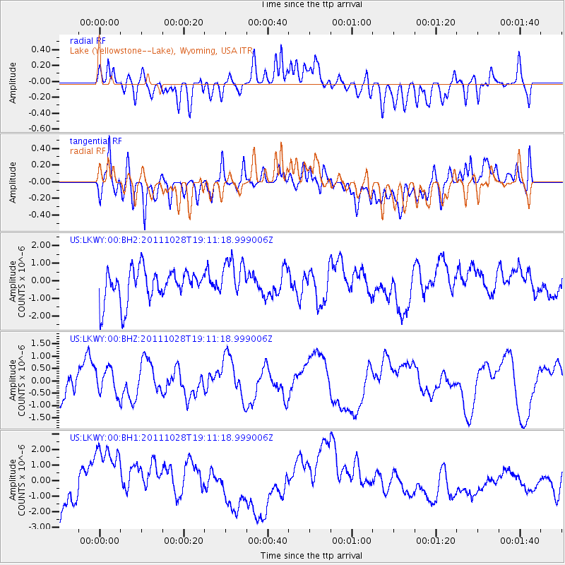
LKWY Lake (Yellowstone--Lake), Wyoming, USA - Earthquake Result Viewer
*The percent match for this event was below the threshold and hence no stack was calculated.
| Earthquake location: |
Near Coast Of Peru |
| Earthquake latitude/longitude: |
-14.4/-76.0 |
| Earthquake time(UTC): |
2011/10/28 (301) 19:01:02 GMT |
| Earthquake Depth: |
22 km |
| Earthquake Magnitude: |
5.6 MB |
| Earthquake Catalog/Contributor: |
WHDF/NEIC |
|
| Network: |
US United States National Seismic Network |
| Station: |
LKWY Lake (Yellowstone--Lake), Wyoming, USA |
| Lat/Lon: |
44.57 N/110.40 W |
| Elevation: |
2424 m |
|
| Distance: |
66.5 deg |
| Az: |
333.869 deg |
| Baz: |
143.337 deg |
| Ray Param: |
$rayparam |
*The percent match for this event was below the threshold and hence was not used in the summary stack. |
|
| Radial Match: |
45.01405 % |
| Radial Bump: |
400 |
| Transverse Match: |
50.955605 % |
| Transverse Bump: |
400 |
| SOD ConfigId: |
558545 |
| Insert Time: |
2013-09-19 05:24:19.399 +0000 |
| GWidth: |
2.5 |
| Max Bumps: |
400 |
| Tol: |
0.001 |
|
Signal To Noise
| Channel | StoN | STA | LTA |
| US:LKWY:00:BHZ:20111028T19:11:18.999006Z | 0.8906239 | 5.2580816E-7 | 5.9038183E-7 |
| US:LKWY:00:BH1:20111028T19:11:18.999006Z | 2.3548691 | 2.5154482E-6 | 1.0681902E-6 |
| US:LKWY:00:BH2:20111028T19:11:18.999006Z | 1.201118 | 1.1058025E-6 | 9.206444E-7 |
| Arrivals |
| Ps | |
| PpPs | |
| PsPs/PpSs | |


