You are here: Home > Network List > IU - Global Seismograph Network (GSN - IRIS/USGS) Stations List
> Station RSSD Black Hills, South Dakota, USA > Earthquake Result Viewer
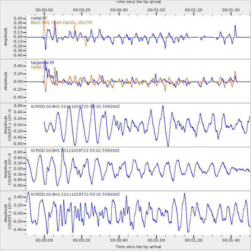
RSSD Black Hills, South Dakota, USA - Earthquake Result Viewer
*The percent match for this event was below the threshold and hence no stack was calculated.
| Earthquake location: |
Near Coast Of Peru |
| Earthquake latitude/longitude: |
-14.5/-75.8 |
| Earthquake time(UTC): |
2011/10/28 (301) 23:46:01 GMT |
| Earthquake Depth: |
10 km |
| Earthquake Magnitude: |
5.6 MW, 5.5 MB, 5.8 ML |
| Earthquake Catalog/Contributor: |
NEIC PDE/NEIC PDE-M |
|
| Network: |
IU Global Seismograph Network (GSN - IRIS/USGS) |
| Station: |
RSSD Black Hills, South Dakota, USA |
| Lat/Lon: |
44.12 N/104.04 W |
| Elevation: |
2090 m |
|
| Distance: |
63.8 deg |
| Az: |
337.709 deg |
| Baz: |
149.331 deg |
| Ray Param: |
$rayparam |
*The percent match for this event was below the threshold and hence was not used in the summary stack. |
|
| Radial Match: |
58.418465 % |
| Radial Bump: |
400 |
| Transverse Match: |
66.6943 % |
| Transverse Bump: |
400 |
| SOD ConfigId: |
558545 |
| Insert Time: |
2013-09-19 05:26:17.679 +0000 |
| GWidth: |
2.5 |
| Max Bumps: |
400 |
| Tol: |
0.001 |
|
Signal To Noise
| Channel | StoN | STA | LTA |
| IU:RSSD:00:BHZ:20111028T23:56:02.568999Z | 1.7516593 | 4.996281E-7 | 2.8523132E-7 |
| IU:RSSD:00:BH1:20111028T23:56:02.568999Z | 0.8267076 | 2.1775071E-7 | 2.6339507E-7 |
| IU:RSSD:00:BH2:20111028T23:56:02.568999Z | 0.93115765 | 3.1347477E-7 | 3.366506E-7 |
| Arrivals |
| Ps | |
| PpPs | |
| PsPs/PpSs | |


