You are here: Home > Network List > US - United States National Seismic Network Stations List
> Station SCIA State Center, Iowa, USA > Earthquake Result Viewer
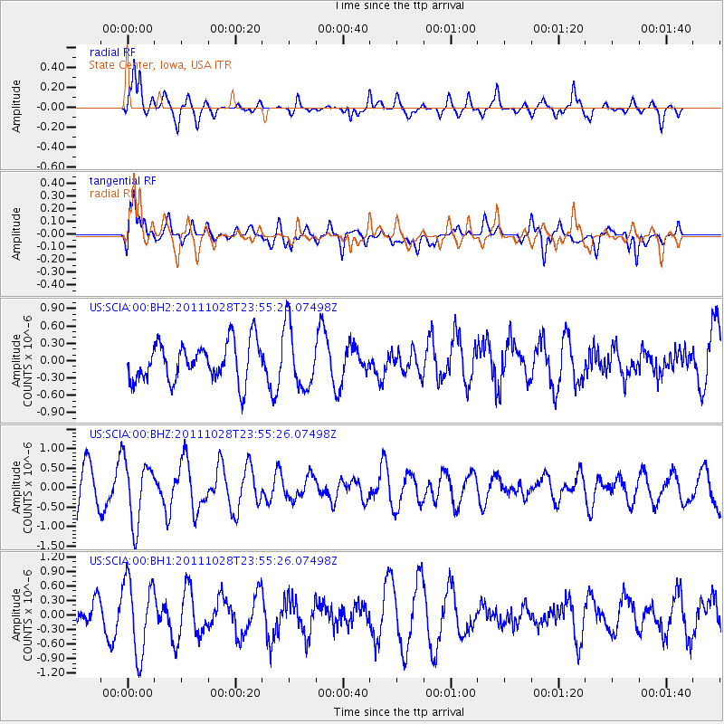
SCIA State Center, Iowa, USA - Earthquake Result Viewer
*The percent match for this event was below the threshold and hence no stack was calculated.
| Earthquake location: |
Near Coast Of Peru |
| Earthquake latitude/longitude: |
-14.5/-75.8 |
| Earthquake time(UTC): |
2011/10/28 (301) 23:46:01 GMT |
| Earthquake Depth: |
10 km |
| Earthquake Magnitude: |
5.6 MW, 5.5 MB, 5.8 ML |
| Earthquake Catalog/Contributor: |
NEIC PDE/NEIC PDE-M |
|
| Network: |
US United States National Seismic Network |
| Station: |
SCIA State Center, Iowa, USA |
| Lat/Lon: |
41.91 N/93.22 W |
| Elevation: |
312 m |
|
| Distance: |
58.4 deg |
| Az: |
344.828 deg |
| Baz: |
160.15 deg |
| Ray Param: |
$rayparam |
*The percent match for this event was below the threshold and hence was not used in the summary stack. |
|
| Radial Match: |
68.28839 % |
| Radial Bump: |
400 |
| Transverse Match: |
64.92331 % |
| Transverse Bump: |
400 |
| SOD ConfigId: |
558545 |
| Insert Time: |
2013-09-19 05:27:41.966 +0000 |
| GWidth: |
2.5 |
| Max Bumps: |
400 |
| Tol: |
0.001 |
|
Signal To Noise
| Channel | StoN | STA | LTA |
| US:SCIA:00:BHZ:20111028T23:55:26.07498Z | 1.9066759 | 8.0482835E-7 | 4.221107E-7 |
| US:SCIA:00:BH1:20111028T23:55:26.07498Z | 2.8775861 | 7.7350535E-7 | 2.6880355E-7 |
| US:SCIA:00:BH2:20111028T23:55:26.07498Z | 1.6280574 | 5.4423924E-7 | 3.342875E-7 |
| Arrivals |
| Ps | |
| PpPs | |
| PsPs/PpSs | |


