You are here: Home > Network List > II - Global Seismograph Network (GSN - IRIS/IDA) Stations List
> Station WRAB Tennant Creek, NT, Australia > Earthquake Result Viewer
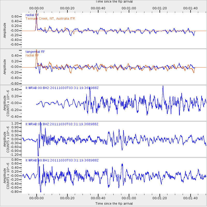
WRAB Tennant Creek, NT, Australia - Earthquake Result Viewer
*The percent match for this event was below the threshold and hence no stack was calculated.
| Earthquake location: |
Taiwan Region |
| Earthquake latitude/longitude: |
25.4/122.9 |
| Earthquake time(UTC): |
2011/10/30 (303) 03:23:46 GMT |
| Earthquake Depth: |
224 km |
| Earthquake Magnitude: |
5.7 MW, 5.4 MB, 5.7 MW |
| Earthquake Catalog/Contributor: |
WHDF/NEIC |
|
| Network: |
II Global Seismograph Network (GSN - IRIS/IDA) |
| Station: |
WRAB Tennant Creek, NT, Australia |
| Lat/Lon: |
19.93 S/134.36 E |
| Elevation: |
366 m |
|
| Distance: |
46.4 deg |
| Az: |
164.996 deg |
| Baz: |
345.586 deg |
| Ray Param: |
$rayparam |
*The percent match for this event was below the threshold and hence was not used in the summary stack. |
|
| Radial Match: |
60.12861 % |
| Radial Bump: |
400 |
| Transverse Match: |
52.644386 % |
| Transverse Bump: |
400 |
| SOD ConfigId: |
558545 |
| Insert Time: |
2013-09-19 05:28:48.695 +0000 |
| GWidth: |
2.5 |
| Max Bumps: |
400 |
| Tol: |
0.001 |
|
Signal To Noise
| Channel | StoN | STA | LTA |
| II:WRAB:00:BHZ:20111030T03:31:19.368988Z | 5.09028 | 5.9092804E-7 | 1.16089495E-7 |
| II:WRAB:00:BH1:20111030T03:31:19.368988Z | 5.0031643 | 4.1485208E-7 | 8.291794E-8 |
| II:WRAB:00:BH2:20111030T03:31:19.368988Z | 3.1866834 | 1.7931177E-7 | 5.6269087E-8 |
| Arrivals |
| Ps | |
| PpPs | |
| PsPs/PpSs | |


