You are here: Home > Network List > IU - Global Seismograph Network (GSN - IRIS/USGS) Stations List
> Station PMG Port Moresby, New Guinea > Earthquake Result Viewer
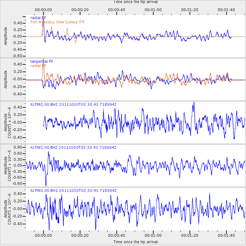
PMG Port Moresby, New Guinea - Earthquake Result Viewer
*The percent match for this event was below the threshold and hence no stack was calculated.
| Earthquake location: |
Taiwan Region |
| Earthquake latitude/longitude: |
25.4/122.9 |
| Earthquake time(UTC): |
2011/10/30 (303) 03:23:46 GMT |
| Earthquake Depth: |
224 km |
| Earthquake Magnitude: |
5.7 MW, 5.4 MB, 5.7 MW |
| Earthquake Catalog/Contributor: |
WHDF/NEIC |
|
| Network: |
IU Global Seismograph Network (GSN - IRIS/USGS) |
| Station: |
PMG Port Moresby, New Guinea |
| Lat/Lon: |
9.40 S/147.16 E |
| Elevation: |
90 m |
|
| Distance: |
41.9 deg |
| Az: |
142.556 deg |
| Baz: |
326.123 deg |
| Ray Param: |
$rayparam |
*The percent match for this event was below the threshold and hence was not used in the summary stack. |
|
| Radial Match: |
56.783188 % |
| Radial Bump: |
400 |
| Transverse Match: |
52.05646 % |
| Transverse Bump: |
400 |
| SOD ConfigId: |
558545 |
| Insert Time: |
2013-09-19 05:29:20.551 +0000 |
| GWidth: |
2.5 |
| Max Bumps: |
400 |
| Tol: |
0.001 |
|
Signal To Noise
| Channel | StoN | STA | LTA |
| IU:PMG:00:BHZ:20111030T03:30:43.718994Z | 2.8547034 | 3.7111485E-7 | 1.300012E-7 |
| IU:PMG:00:BH1:20111030T03:30:43.718994Z | 1.6090852 | 2.2466358E-7 | 1.3962192E-7 |
| IU:PMG:00:BH2:20111030T03:30:43.718994Z | 1.827336 | 1.4920472E-7 | 8.16515E-8 |
| Arrivals |
| Ps | |
| PpPs | |
| PsPs/PpSs | |


