You are here: Home > Network List > IU - Global Seismograph Network (GSN - IRIS/USGS) Stations List
> Station HNR Honiara, Solomon Islands > Earthquake Result Viewer
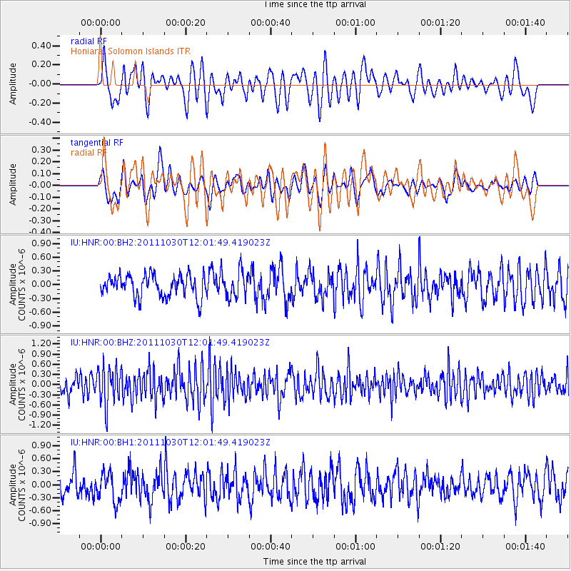
HNR Honiara, Solomon Islands - Earthquake Result Viewer
*The percent match for this event was below the threshold and hence no stack was calculated.
| Earthquake location: |
Southern Sumatra, Indonesia |
| Earthquake latitude/longitude: |
-3.2/101.3 |
| Earthquake time(UTC): |
2011/10/30 (303) 11:52:27 GMT |
| Earthquake Depth: |
36 km |
| Earthquake Magnitude: |
5.6 MB, 5.1 MS, 5.6 MW, 5.6 MW |
| Earthquake Catalog/Contributor: |
WHDF/NEIC |
|
| Network: |
IU Global Seismograph Network (GSN - IRIS/USGS) |
| Station: |
HNR Honiara, Solomon Islands |
| Lat/Lon: |
9.44 S/159.95 E |
| Elevation: |
100 m |
|
| Distance: |
58.5 deg |
| Az: |
99.023 deg |
| Baz: |
271.962 deg |
| Ray Param: |
$rayparam |
*The percent match for this event was below the threshold and hence was not used in the summary stack. |
|
| Radial Match: |
61.105816 % |
| Radial Bump: |
400 |
| Transverse Match: |
52.412327 % |
| Transverse Bump: |
372 |
| SOD ConfigId: |
558545 |
| Insert Time: |
2013-09-19 05:30:35.881 +0000 |
| GWidth: |
2.5 |
| Max Bumps: |
400 |
| Tol: |
0.001 |
|
Signal To Noise
| Channel | StoN | STA | LTA |
| IU:HNR:00:BHZ:20111030T12:01:49.419023Z | 2.449155 | 5.6235274E-7 | 2.2961092E-7 |
| IU:HNR:00:BH1:20111030T12:01:49.419023Z | 1.4526397 | 3.4107384E-7 | 2.3479589E-7 |
| IU:HNR:00:BH2:20111030T12:01:49.419023Z | 1.1746285 | 2.8268477E-7 | 2.4065886E-7 |
| Arrivals |
| Ps | |
| PpPs | |
| PsPs/PpSs | |


