You are here: Home > Network List > CN - Canadian National Seismograph Network Stations List
> Station INK INUVIK, NT, CANADA.ANADA > Earthquake Result Viewer
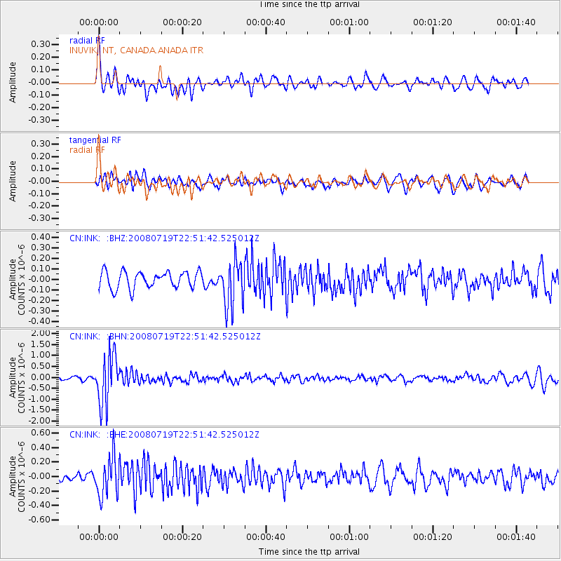
INK INUVIK, NT, CANADA.ANADA - Earthquake Result Viewer
*The percent match for this event was below the threshold and hence no stack was calculated.
| Earthquake location: |
Fiji Islands Region |
| Earthquake latitude/longitude: |
-17.3/-177.3 |
| Earthquake time(UTC): |
2008/07/19 (201) 22:39:52 GMT |
| Earthquake Depth: |
391 km |
| Earthquake Magnitude: |
5.9 MB, 6.4 MW, 6.4 MW |
| Earthquake Catalog/Contributor: |
WHDF/NEIC |
|
| Network: |
CN Canadian National Seismograph Network |
| Station: |
INK INUVIK, NT, CANADA.ANADA |
| Lat/Lon: |
68.31 N/133.52 W |
| Elevation: |
40 m |
|
| Distance: |
91.1 deg |
| Az: |
14.912 deg |
| Baz: |
221.384 deg |
| Ray Param: |
$rayparam |
*The percent match for this event was below the threshold and hence was not used in the summary stack. |
|
| Radial Match: |
77.10383 % |
| Radial Bump: |
400 |
| Transverse Match: |
69.86306 % |
| Transverse Bump: |
400 |
| SOD ConfigId: |
2504 |
| Insert Time: |
2010-02-27 06:31:50.304 +0000 |
| GWidth: |
2.5 |
| Max Bumps: |
400 |
| Tol: |
0.001 |
|
Signal To Noise
| Channel | StoN | STA | LTA |
| CN:INK: :BHN:20080719T22:51:42.525012Z | 14.124869 | 1.1314519E-6 | 8.010353E-8 |
| CN:INK: :BHE:20080719T22:51:42.525012Z | 7.7632704 | 2.7113356E-7 | 3.4925176E-8 |
| CN:INK: :BHZ:20080719T22:51:42.525012Z | 2.7767427 | 2.2121345E-7 | 7.9666535E-8 |
| Arrivals |
| Ps | |
| PpPs | |
| PsPs/PpSs | |


