You are here: Home > Network List > US - United States National Seismic Network Stations List
> Station EGMT Eagleton, Montana, USA > Earthquake Result Viewer
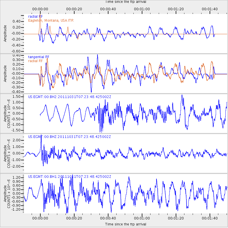
EGMT Eagleton, Montana, USA - Earthquake Result Viewer
*The percent match for this event was below the threshold and hence no stack was calculated.
| Earthquake location: |
Rat Islands, Aleutian Islands |
| Earthquake latitude/longitude: |
52.4/177.9 |
| Earthquake time(UTC): |
2011/10/31 (304) 07:16:21 GMT |
| Earthquake Depth: |
159 km |
| Earthquake Magnitude: |
5.8 MB, 5.8 MW, 5.9 MW |
| Earthquake Catalog/Contributor: |
WHDF/NEIC |
|
| Network: |
US United States National Seismic Network |
| Station: |
EGMT Eagleton, Montana, USA |
| Lat/Lon: |
48.02 N/109.75 W |
| Elevation: |
1055 m |
|
| Distance: |
44.7 deg |
| Az: |
65.358 deg |
| Baz: |
303.876 deg |
| Ray Param: |
$rayparam |
*The percent match for this event was below the threshold and hence was not used in the summary stack. |
|
| Radial Match: |
55.04833 % |
| Radial Bump: |
400 |
| Transverse Match: |
65.13996 % |
| Transverse Bump: |
400 |
| SOD ConfigId: |
558545 |
| Insert Time: |
2013-09-19 05:40:21.654 +0000 |
| GWidth: |
2.5 |
| Max Bumps: |
400 |
| Tol: |
0.001 |
|
Signal To Noise
| Channel | StoN | STA | LTA |
| US:EGMT:00:BHZ:20111031T07:23:48.425002Z | 3.8053517 | 1.03842E-6 | 2.728841E-7 |
| US:EGMT:00:BH1:20111031T07:23:48.425002Z | 1.2713616 | 6.14629E-7 | 4.8344157E-7 |
| US:EGMT:00:BH2:20111031T07:23:48.425002Z | 0.6986187 | 3.4120941E-7 | 4.8840576E-7 |
| Arrivals |
| Ps | |
| PpPs | |
| PsPs/PpSs | |


