You are here: Home > Network List > US - United States National Seismic Network Stations List
> Station ERPA Erie, Pennsylvania, USA > Earthquake Result Viewer
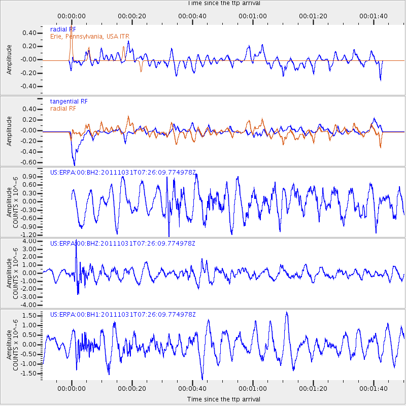
ERPA Erie, Pennsylvania, USA - Earthquake Result Viewer
*The percent match for this event was below the threshold and hence no stack was calculated.
| Earthquake location: |
Rat Islands, Aleutian Islands |
| Earthquake latitude/longitude: |
52.4/177.9 |
| Earthquake time(UTC): |
2011/10/31 (304) 07:16:21 GMT |
| Earthquake Depth: |
159 km |
| Earthquake Magnitude: |
5.8 MB, 5.8 MW, 5.9 MW |
| Earthquake Catalog/Contributor: |
WHDF/NEIC |
|
| Network: |
US United States National Seismic Network |
| Station: |
ERPA Erie, Pennsylvania, USA |
| Lat/Lon: |
42.12 N/79.99 W |
| Elevation: |
306 m |
|
| Distance: |
64.4 deg |
| Az: |
53.789 deg |
| Baz: |
318.32 deg |
| Ray Param: |
$rayparam |
*The percent match for this event was below the threshold and hence was not used in the summary stack. |
|
| Radial Match: |
67.80554 % |
| Radial Bump: |
400 |
| Transverse Match: |
67.382256 % |
| Transverse Bump: |
400 |
| SOD ConfigId: |
558545 |
| Insert Time: |
2013-09-19 05:40:23.619 +0000 |
| GWidth: |
2.5 |
| Max Bumps: |
400 |
| Tol: |
0.001 |
|
Signal To Noise
| Channel | StoN | STA | LTA |
| US:ERPA:00:BHZ:20111031T07:26:09.774978Z | 2.17094 | 1.2498373E-6 | 5.7571253E-7 |
| US:ERPA:00:BH1:20111031T07:26:09.774978Z | 0.6503956 | 5.138512E-7 | 7.900595E-7 |
| US:ERPA:00:BH2:20111031T07:26:09.774978Z | 0.98844033 | 4.8106494E-7 | 4.866909E-7 |
| Arrivals |
| Ps | |
| PpPs | |
| PsPs/PpSs | |


