You are here: Home > Network List > US - United States National Seismic Network Stations List
> Station MIAR Mount Ida, Arkansas, USA > Earthquake Result Viewer
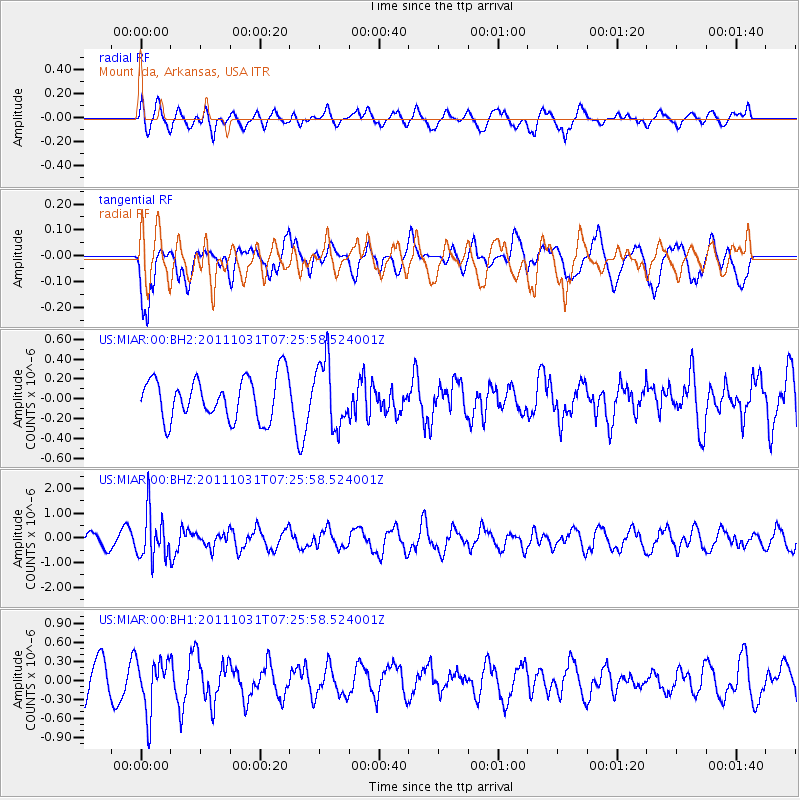
MIAR Mount Ida, Arkansas, USA - Earthquake Result Viewer
*The percent match for this event was below the threshold and hence no stack was calculated.
| Earthquake location: |
Rat Islands, Aleutian Islands |
| Earthquake latitude/longitude: |
52.4/177.9 |
| Earthquake time(UTC): |
2011/10/31 (304) 07:16:21 GMT |
| Earthquake Depth: |
159 km |
| Earthquake Magnitude: |
5.8 MB, 5.8 MW, 5.9 MW |
| Earthquake Catalog/Contributor: |
WHDF/NEIC |
|
| Network: |
US United States National Seismic Network |
| Station: |
MIAR Mount Ida, Arkansas, USA |
| Lat/Lon: |
34.55 N/93.58 W |
| Elevation: |
207 m |
|
| Distance: |
62.7 deg |
| Az: |
68.265 deg |
| Baz: |
316.367 deg |
| Ray Param: |
$rayparam |
*The percent match for this event was below the threshold and hence was not used in the summary stack. |
|
| Radial Match: |
42.78838 % |
| Radial Bump: |
400 |
| Transverse Match: |
61.520382 % |
| Transverse Bump: |
400 |
| SOD ConfigId: |
558545 |
| Insert Time: |
2013-09-19 05:41:01.667 +0000 |
| GWidth: |
2.5 |
| Max Bumps: |
400 |
| Tol: |
0.001 |
|
Signal To Noise
| Channel | StoN | STA | LTA |
| US:MIAR:00:BHZ:20111031T07:25:58.524001Z | 3.1980755 | 9.3872404E-7 | 2.935278E-7 |
| US:MIAR:00:BH1:20111031T07:25:58.524001Z | 1.2205678 | 4.1644168E-7 | 3.4118682E-7 |
| US:MIAR:00:BH2:20111031T07:25:58.524001Z | 1.5905977 | 3.3535042E-7 | 2.1083297E-7 |
| Arrivals |
| Ps | |
| PpPs | |
| PsPs/PpSs | |


