You are here: Home > Network List > US - United States National Seismic Network Stations List
> Station TPNV Topopah Spring, Nevada, USA > Earthquake Result Viewer
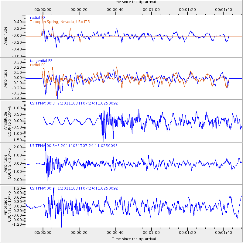
TPNV Topopah Spring, Nevada, USA - Earthquake Result Viewer
*The percent match for this event was below the threshold and hence no stack was calculated.
| Earthquake location: |
Rat Islands, Aleutian Islands |
| Earthquake latitude/longitude: |
52.4/177.9 |
| Earthquake time(UTC): |
2011/10/31 (304) 07:16:21 GMT |
| Earthquake Depth: |
159 km |
| Earthquake Magnitude: |
5.8 MB, 5.8 MW, 5.9 MW |
| Earthquake Catalog/Contributor: |
WHDF/NEIC |
|
| Network: |
US United States National Seismic Network |
| Station: |
TPNV Topopah Spring, Nevada, USA |
| Lat/Lon: |
36.95 N/116.25 W |
| Elevation: |
1600 m |
|
| Distance: |
47.6 deg |
| Az: |
81.61 deg |
| Baz: |
310.779 deg |
| Ray Param: |
$rayparam |
*The percent match for this event was below the threshold and hence was not used in the summary stack. |
|
| Radial Match: |
65.69843 % |
| Radial Bump: |
400 |
| Transverse Match: |
58.406445 % |
| Transverse Bump: |
400 |
| SOD ConfigId: |
558545 |
| Insert Time: |
2013-09-19 05:41:35.031 +0000 |
| GWidth: |
2.5 |
| Max Bumps: |
400 |
| Tol: |
0.001 |
|
Signal To Noise
| Channel | StoN | STA | LTA |
| US:TPNV:00:BHZ:20111031T07:24:11.025009Z | 6.918353 | 9.775017E-7 | 1.412911E-7 |
| US:TPNV:00:BH1:20111031T07:24:11.025009Z | 1.6765221 | 3.7877498E-7 | 2.25929E-7 |
| US:TPNV:00:BH2:20111031T07:24:11.025009Z | 3.3608508 | 6.30457E-7 | 1.8758851E-7 |
| Arrivals |
| Ps | |
| PpPs | |
| PsPs/PpSs | |


