You are here: Home > Network List > US - United States National Seismic Network Stations List
> Station WUAZ Wupatki, Arizona, USA > Earthquake Result Viewer
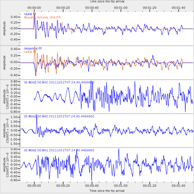
WUAZ Wupatki, Arizona, USA - Earthquake Result Viewer
*The percent match for this event was below the threshold and hence no stack was calculated.
| Earthquake location: |
Rat Islands, Aleutian Islands |
| Earthquake latitude/longitude: |
52.4/177.9 |
| Earthquake time(UTC): |
2011/10/31 (304) 07:16:21 GMT |
| Earthquake Depth: |
159 km |
| Earthquake Magnitude: |
5.8 MB, 5.8 MW, 5.9 MW |
| Earthquake Catalog/Contributor: |
WHDF/NEIC |
|
| Network: |
US United States National Seismic Network |
| Station: |
WUAZ Wupatki, Arizona, USA |
| Lat/Lon: |
35.52 N/111.37 W |
| Elevation: |
1592 m |
|
| Distance: |
51.5 deg |
| Az: |
79.58 deg |
| Baz: |
312.332 deg |
| Ray Param: |
$rayparam |
*The percent match for this event was below the threshold and hence was not used in the summary stack. |
|
| Radial Match: |
70.552055 % |
| Radial Bump: |
400 |
| Transverse Match: |
58.67392 % |
| Transverse Bump: |
400 |
| SOD ConfigId: |
558545 |
| Insert Time: |
2013-09-19 05:41:41.916 +0000 |
| GWidth: |
2.5 |
| Max Bumps: |
400 |
| Tol: |
0.001 |
|
Signal To Noise
| Channel | StoN | STA | LTA |
| US:WUAZ:00:BHZ:20111031T07:24:40.449996Z | 3.8950562 | 5.172071E-7 | 1.3278553E-7 |
| US:WUAZ:00:BH1:20111031T07:24:40.449996Z | 2.0295577 | 2.7748746E-7 | 1.3672312E-7 |
| US:WUAZ:00:BH2:20111031T07:24:40.449996Z | 1.5049373 | 2.620435E-7 | 1.7412253E-7 |
| Arrivals |
| Ps | |
| PpPs | |
| PsPs/PpSs | |


