You are here: Home > Network List > II - Global Seismograph Network (GSN - IRIS/IDA) Stations List
> Station WRAB Tennant Creek, NT, Australia > Earthquake Result Viewer
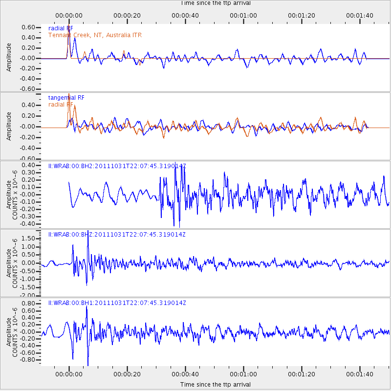
WRAB Tennant Creek, NT, Australia - Earthquake Result Viewer
*The percent match for this event was below the threshold and hence no stack was calculated.
| Earthquake location: |
Sichuan, China |
| Earthquake latitude/longitude: |
32.5/105.3 |
| Earthquake time(UTC): |
2011/10/31 (304) 21:58:19 GMT |
| Earthquake Depth: |
40 km |
| Earthquake Magnitude: |
5.6 MB |
| Earthquake Catalog/Contributor: |
NEIC PDE/NEIC PDE-M |
|
| Network: |
II Global Seismograph Network (GSN - IRIS/IDA) |
| Station: |
WRAB Tennant Creek, NT, Australia |
| Lat/Lon: |
19.93 S/134.36 E |
| Elevation: |
366 m |
|
| Distance: |
59.1 deg |
| Az: |
147.845 deg |
| Baz: |
331.454 deg |
| Ray Param: |
$rayparam |
*The percent match for this event was below the threshold and hence was not used in the summary stack. |
|
| Radial Match: |
63.955605 % |
| Radial Bump: |
400 |
| Transverse Match: |
61.525642 % |
| Transverse Bump: |
400 |
| SOD ConfigId: |
558545 |
| Insert Time: |
2013-09-19 05:42:41.430 +0000 |
| GWidth: |
2.5 |
| Max Bumps: |
400 |
| Tol: |
0.001 |
|
Signal To Noise
| Channel | StoN | STA | LTA |
| II:WRAB:00:BHZ:20111031T22:07:45.319014Z | 3.8116086 | 3.691546E-7 | 9.685008E-8 |
| II:WRAB:00:BH1:20111031T22:07:45.319014Z | 3.1401927 | 2.4753203E-7 | 7.882702E-8 |
| II:WRAB:00:BH2:20111031T22:07:45.319014Z | 1.6901389 | 1.2550689E-7 | 7.4258324E-8 |
| Arrivals |
| Ps | |
| PpPs | |
| PsPs/PpSs | |


