You are here: Home > Network List > IU - Global Seismograph Network (GSN - IRIS/USGS) Stations List
> Station MAJO Matsushiro, Japan > Earthquake Result Viewer
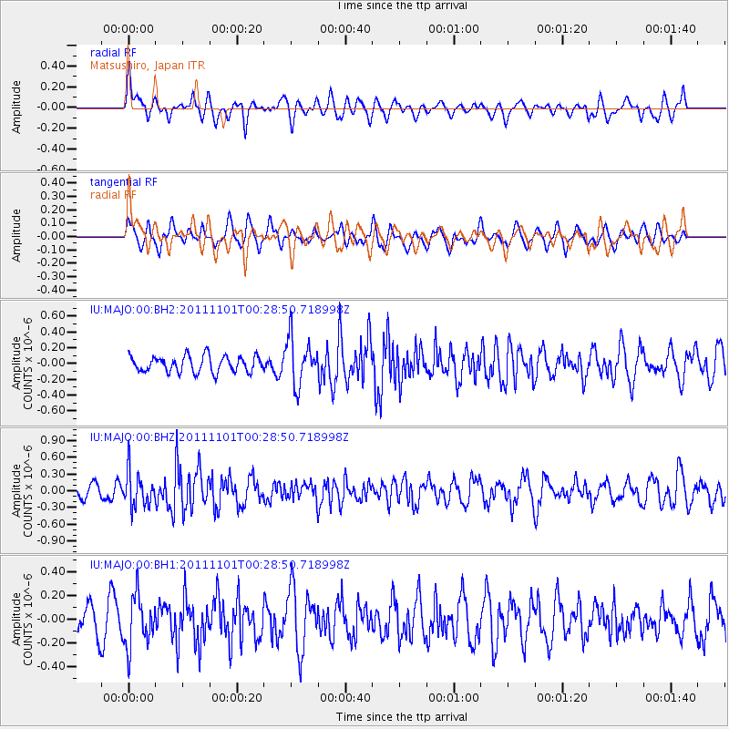
MAJO Matsushiro, Japan - Earthquake Result Viewer
*The percent match for this event was below the threshold and hence no stack was calculated.
| Earthquake location: |
Northern Xinjiang, China |
| Earthquake latitude/longitude: |
43.6/82.4 |
| Earthquake time(UTC): |
2011/11/01 (305) 00:21:28 GMT |
| Earthquake Depth: |
28 km |
| Earthquake Magnitude: |
6.0 MB, 5.4 MS, 5.6 MW, 5.4 MW |
| Earthquake Catalog/Contributor: |
WHDF/NEIC |
|
| Network: |
IU Global Seismograph Network (GSN - IRIS/USGS) |
| Station: |
MAJO Matsushiro, Japan |
| Lat/Lon: |
36.55 N/138.20 E |
| Elevation: |
405 m |
|
| Distance: |
42.6 deg |
| Az: |
79.884 deg |
| Baz: |
297.451 deg |
| Ray Param: |
$rayparam |
*The percent match for this event was below the threshold and hence was not used in the summary stack. |
|
| Radial Match: |
66.271126 % |
| Radial Bump: |
400 |
| Transverse Match: |
57.867508 % |
| Transverse Bump: |
400 |
| SOD ConfigId: |
558545 |
| Insert Time: |
2013-09-19 05:44:58.841 +0000 |
| GWidth: |
2.5 |
| Max Bumps: |
400 |
| Tol: |
0.001 |
|
Signal To Noise
| Channel | StoN | STA | LTA |
| IU:MAJO:00:BHZ:20111101T00:28:50.718998Z | 3.2989461 | 3.1365633E-7 | 9.507774E-8 |
| IU:MAJO:00:BH1:20111101T00:28:50.718998Z | 1.7158284 | 2.1860056E-7 | 1.2740234E-7 |
| IU:MAJO:00:BH2:20111101T00:28:50.718998Z | 2.9284189 | 3.0155206E-7 | 1.02974354E-7 |
| Arrivals |
| Ps | |
| PpPs | |
| PsPs/PpSs | |


