You are here: Home > Network List > II - Global Seismograph Network (GSN - IRIS/IDA) Stations List
> Station WRAB Tennant Creek, NT, Australia > Earthquake Result Viewer
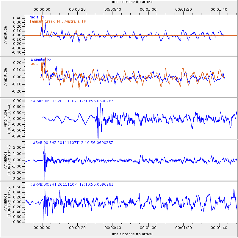
WRAB Tennant Creek, NT, Australia - Earthquake Result Viewer
*The percent match for this event was below the threshold and hence no stack was calculated.
| Earthquake location: |
Afghanistan-Tajikistan Bord Reg. |
| Earthquake latitude/longitude: |
36.5/71.1 |
| Earthquake time(UTC): |
2011/11/07 (311) 11:59:31 GMT |
| Earthquake Depth: |
212 km |
| Earthquake Magnitude: |
5.7 MB, 5.6 MW, 5.7 MW |
| Earthquake Catalog/Contributor: |
WHDF/NEIC |
|
| Network: |
II Global Seismograph Network (GSN - IRIS/IDA) |
| Station: |
WRAB Tennant Creek, NT, Australia |
| Lat/Lon: |
19.93 S/134.36 E |
| Elevation: |
366 m |
|
| Distance: |
81.9 deg |
| Az: |
121.941 deg |
| Baz: |
313.385 deg |
| Ray Param: |
$rayparam |
*The percent match for this event was below the threshold and hence was not used in the summary stack. |
|
| Radial Match: |
49.69891 % |
| Radial Bump: |
400 |
| Transverse Match: |
62.834656 % |
| Transverse Bump: |
400 |
| SOD ConfigId: |
558545 |
| Insert Time: |
2013-09-19 06:03:39.788 +0000 |
| GWidth: |
2.5 |
| Max Bumps: |
400 |
| Tol: |
0.001 |
|
Signal To Noise
| Channel | StoN | STA | LTA |
| II:WRAB:00:BHZ:20111107T12:10:56.069028Z | 7.3042717 | 9.643342E-7 | 1.3202332E-7 |
| II:WRAB:00:BH1:20111107T12:10:56.069028Z | 3.188323 | 2.3815504E-7 | 7.469602E-8 |
| II:WRAB:00:BH2:20111107T12:10:56.069028Z | 3.3462617 | 3.773122E-7 | 1.12756325E-7 |
| Arrivals |
| Ps | |
| PpPs | |
| PsPs/PpSs | |


