You are here: Home > Network List > US - United States National Seismic Network Stations List
> Station HAWA Hanford, Washington, USA > Earthquake Result Viewer
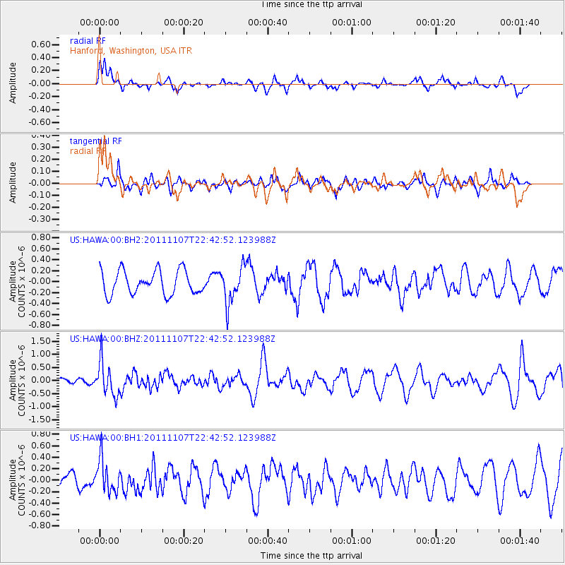
HAWA Hanford, Washington, USA - Earthquake Result Viewer
*The percent match for this event was below the threshold and hence no stack was calculated.
| Earthquake location: |
Nicaragua |
| Earthquake latitude/longitude: |
11.6/-85.9 |
| Earthquake time(UTC): |
2011/11/07 (311) 22:35:25 GMT |
| Earthquake Depth: |
177 km |
| Earthquake Magnitude: |
6.0 MB, 6.0 MW, 6.1 MW |
| Earthquake Catalog/Contributor: |
WHDF/NEIC |
|
| Network: |
US United States National Seismic Network |
| Station: |
HAWA Hanford, Washington, USA |
| Lat/Lon: |
46.39 N/119.53 W |
| Elevation: |
364 m |
|
| Distance: |
44.9 deg |
| Az: |
327.076 deg |
| Baz: |
129.685 deg |
| Ray Param: |
$rayparam |
*The percent match for this event was below the threshold and hence was not used in the summary stack. |
|
| Radial Match: |
68.04741 % |
| Radial Bump: |
310 |
| Transverse Match: |
49.224644 % |
| Transverse Bump: |
400 |
| SOD ConfigId: |
558545 |
| Insert Time: |
2013-09-19 06:08:18.933 +0000 |
| GWidth: |
2.5 |
| Max Bumps: |
400 |
| Tol: |
0.001 |
|
Signal To Noise
| Channel | StoN | STA | LTA |
| US:HAWA:00:BHZ:20111107T22:42:52.123988Z | 3.0946388 | 6.665752E-7 | 2.1539678E-7 |
| US:HAWA:00:BH1:20111107T22:42:52.123988Z | 1.7819452 | 3.0205004E-7 | 1.695058E-7 |
| US:HAWA:00:BH2:20111107T22:42:52.123988Z | 1.5645179 | 3.3881287E-7 | 2.1656057E-7 |
| Arrivals |
| Ps | |
| PpPs | |
| PsPs/PpSs | |


