You are here: Home > Network List > US - United States National Seismic Network Stations List
> Station DGMT Dagmar, Montana, USA > Earthquake Result Viewer
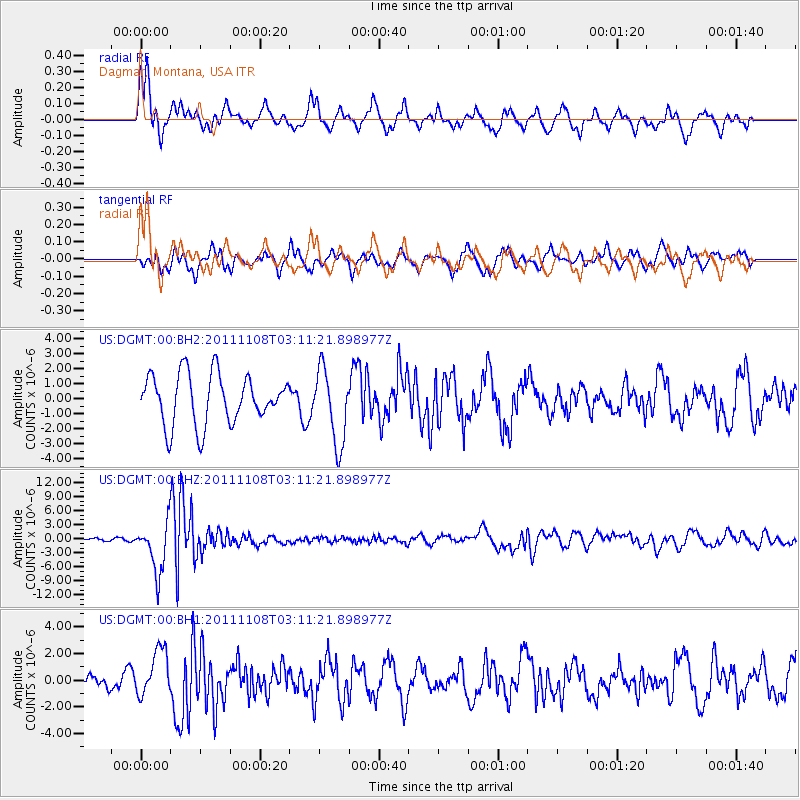
DGMT Dagmar, Montana, USA - Earthquake Result Viewer
*The percent match for this event was below the threshold and hence no stack was calculated.
| Earthquake location: |
Northeast Of Taiwan |
| Earthquake latitude/longitude: |
27.3/125.6 |
| Earthquake time(UTC): |
2011/11/08 (312) 02:59:08 GMT |
| Earthquake Depth: |
225 km |
| Earthquake Magnitude: |
6.5 MB, 6.9 MW, 6.9 MW |
| Earthquake Catalog/Contributor: |
WHDF/NEIC |
|
| Network: |
US United States National Seismic Network |
| Station: |
DGMT Dagmar, Montana, USA |
| Lat/Lon: |
48.47 N/104.20 W |
| Elevation: |
0.0 m |
|
| Distance: |
92.4 deg |
| Az: |
30.588 deg |
| Baz: |
317.135 deg |
| Ray Param: |
$rayparam |
*The percent match for this event was below the threshold and hence was not used in the summary stack. |
|
| Radial Match: |
70.02883 % |
| Radial Bump: |
385 |
| Transverse Match: |
57.826454 % |
| Transverse Bump: |
400 |
| SOD ConfigId: |
558545 |
| Insert Time: |
2013-09-19 06:11:43.687 +0000 |
| GWidth: |
2.5 |
| Max Bumps: |
400 |
| Tol: |
0.001 |
|
Signal To Noise
| Channel | StoN | STA | LTA |
| US:DGMT:00:BHZ:20111108T03:11:21.898977Z | 25.20173 | 5.304404E-6 | 2.1047775E-7 |
| US:DGMT:00:BH1:20111108T03:11:21.898977Z | 3.4725301 | 1.7587536E-6 | 5.064761E-7 |
| US:DGMT:00:BH2:20111108T03:11:21.898977Z | 1.5134711 | 2.4882268E-6 | 1.644053E-6 |
| Arrivals |
| Ps | |
| PpPs | |
| PsPs/PpSs | |


