You are here: Home > Network List > IU - Global Seismograph Network (GSN - IRIS/USGS) Stations List
> Station RSSD Black Hills, South Dakota, USA > Earthquake Result Viewer
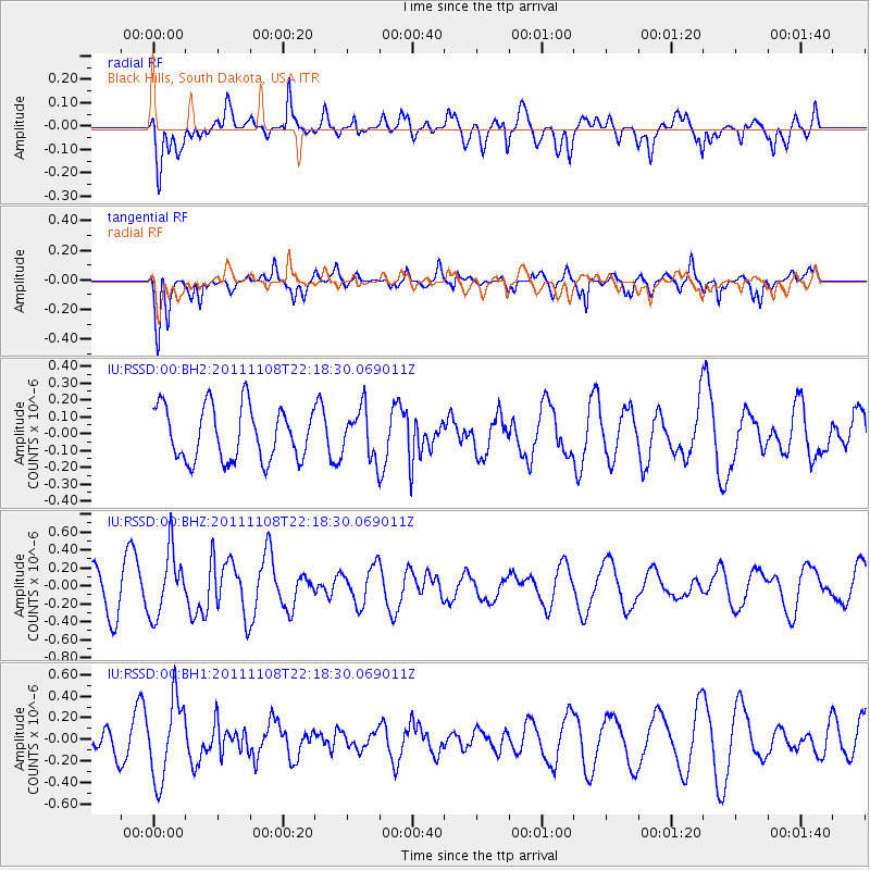
RSSD Black Hills, South Dakota, USA - Earthquake Result Viewer
*The percent match for this event was below the threshold and hence no stack was calculated.
| Earthquake location: |
Turkey |
| Earthquake latitude/longitude: |
38.7/43.2 |
| Earthquake time(UTC): |
2011/11/08 (312) 22:05:51 GMT |
| Earthquake Depth: |
10 km |
| Earthquake Magnitude: |
5.6 MB |
| Earthquake Catalog/Contributor: |
NEIC PDE/NEIC PDE-M |
|
| Network: |
IU Global Seismograph Network (GSN - IRIS/USGS) |
| Station: |
RSSD Black Hills, South Dakota, USA |
| Lat/Lon: |
44.12 N/104.04 W |
| Elevation: |
2090 m |
|
| Distance: |
92.4 deg |
| Az: |
337.034 deg |
| Baz: |
25.076 deg |
| Ray Param: |
$rayparam |
*The percent match for this event was below the threshold and hence was not used in the summary stack. |
|
| Radial Match: |
57.662575 % |
| Radial Bump: |
400 |
| Transverse Match: |
72.40618 % |
| Transverse Bump: |
400 |
| SOD ConfigId: |
558545 |
| Insert Time: |
2013-09-19 06:13:51.996 +0000 |
| GWidth: |
2.5 |
| Max Bumps: |
400 |
| Tol: |
0.001 |
|
Signal To Noise
| Channel | StoN | STA | LTA |
| IU:RSSD:00:BHZ:20111108T22:18:30.069011Z | 1.6186141 | 3.5970123E-7 | 2.2222791E-7 |
| IU:RSSD:00:BH1:20111108T22:18:30.069011Z | 3.186034 | 3.6851065E-7 | 1.1566438E-7 |
| IU:RSSD:00:BH2:20111108T22:18:30.069011Z | 0.92541623 | 1.4562512E-7 | 1.5736174E-7 |
| Arrivals |
| Ps | |
| PpPs | |
| PsPs/PpSs | |


