LLLB LILLOOET, BC, CANADA ADA - Earthquake Result Viewer
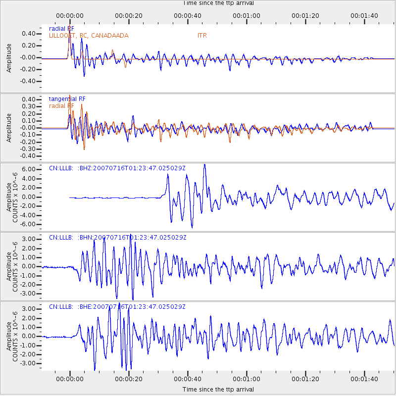
Earthquake location: Near West Coast Of Honshu, Japan
Earthquake latitude/longitude: 37.5/138.4
Earthquake time(UTC): 2007/07/16 (197) 01:13:22 GMT
Earthquake Depth: 12 km
Earthquake Magnitude: 6.5 MB, 6.4 MS, 6.6 MW, 6.5 MW
Earthquake Catalog/Contributor: WHDF/NEIC
Network: CN Canadian National Seismograph Network
Station: LLLB LILLOOET, BC, CANADA ADA
Lat/Lon: 50.61 N/121.88 W
Elevation: 700 m
Distance: 67.5 deg
Az: 42.827 deg
Baz: 301.99 deg
Ray Param: 0.0569038
Estimated Moho Depth: 10.75 km
Estimated Crust Vp/Vs: 1.60
Assumed Crust Vp: 6.597 km/s
Estimated Crust Vs: 4.123 km/s
Estimated Crust Poisson's Ratio: 0.18
Radial Match: 85.95444 %
Radial Bump: 400
Transverse Match: 90.7227 %
Transverse Bump: 400
SOD ConfigId: 2564
Insert Time: 2010-02-27 06:32:39.989 +0000
GWidth: 2.5
Max Bumps: 400
Tol: 0.001

Signal To Noise

ChannelStoNSTALTA
CN:LLLB: :BHN:20070716T01:23:47.025029Z15.3462977.059198E-74.5999354E-8
CN:LLLB: :BHE:20070716T01:23:47.025029Z9.9617594.8234006E-74.8419164E-8
CN:LLLB: :BHZ:20070716T01:23:47.025029Z43.2416082.3584487E-65.454119E-8
Arrivals
Ps1.0 SECOND
PpPs4.0 SECOND
PsPs/PpSs5.1 SECOND