You are here: Home > Network List > II - Global Seismograph Network (GSN - IRIS/IDA) Stations List
> Station WRAB Tennant Creek, NT, Australia > Earthquake Result Viewer
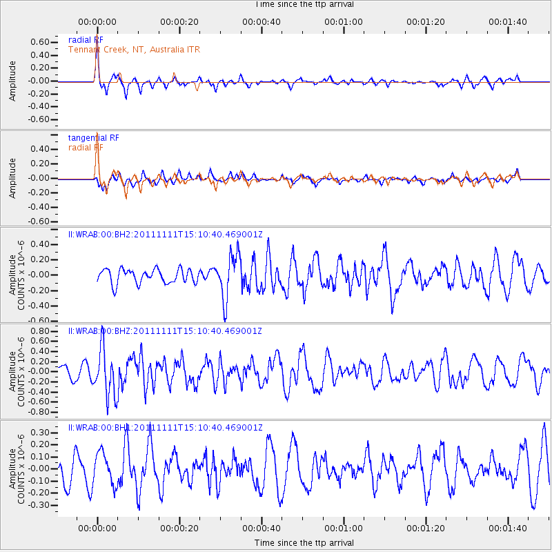
WRAB Tennant Creek, NT, Australia - Earthquake Result Viewer
*The percent match for this event was below the threshold and hence no stack was calculated.
| Earthquake location: |
Tonga Islands |
| Earthquake latitude/longitude: |
-17.7/-173.1 |
| Earthquake time(UTC): |
2011/11/11 (315) 15:02:19 GMT |
| Earthquake Depth: |
10 km |
| Earthquake Magnitude: |
5.5 MB, 5.6 MW |
| Earthquake Catalog/Contributor: |
NEIC PDE/NEIC PDE-M |
|
| Network: |
II Global Seismograph Network (GSN - IRIS/IDA) |
| Station: |
WRAB Tennant Creek, NT, Australia |
| Lat/Lon: |
19.93 S/134.36 E |
| Elevation: |
366 m |
|
| Distance: |
49.6 deg |
| Az: |
258.637 deg |
| Baz: |
96.631 deg |
| Ray Param: |
$rayparam |
*The percent match for this event was below the threshold and hence was not used in the summary stack. |
|
| Radial Match: |
76.25993 % |
| Radial Bump: |
316 |
| Transverse Match: |
54.997856 % |
| Transverse Bump: |
400 |
| SOD ConfigId: |
558545 |
| Insert Time: |
2013-09-19 06:23:33.688 +0000 |
| GWidth: |
2.5 |
| Max Bumps: |
400 |
| Tol: |
0.001 |
|
Signal To Noise
| Channel | StoN | STA | LTA |
| II:WRAB:00:BHZ:20111111T15:10:40.469001Z | 4.4773984 | 4.8104897E-7 | 1.0743939E-7 |
| II:WRAB:00:BH1:20111111T15:10:40.469001Z | 1.3368351 | 1.3290212E-7 | 9.941548E-8 |
| II:WRAB:00:BH2:20111111T15:10:40.469001Z | 3.3070238 | 2.9917712E-7 | 9.0467175E-8 |
| Arrivals |
| Ps | |
| PpPs | |
| PsPs/PpSs | |


