You are here: Home > Network List > US - United States National Seismic Network Stations List
> Station EGMT Eagleton, Montana, USA > Earthquake Result Viewer
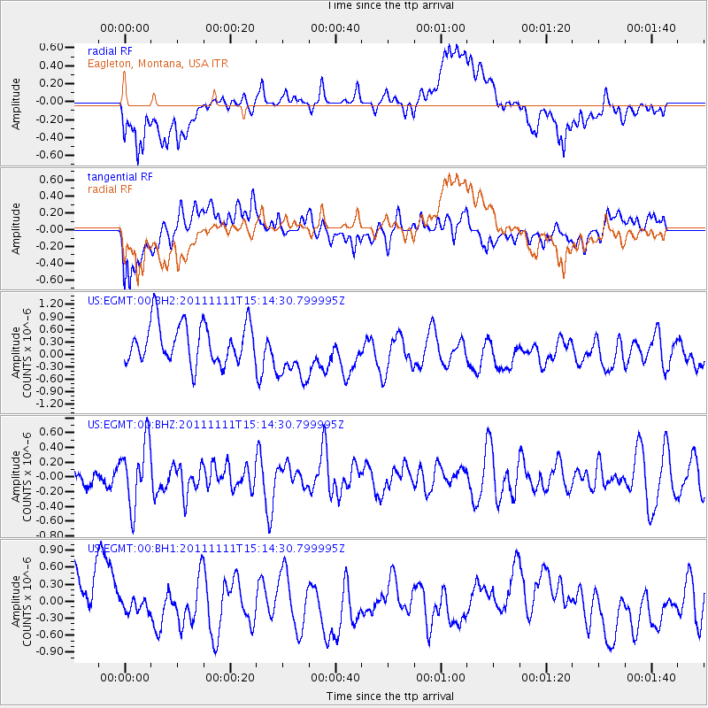
EGMT Eagleton, Montana, USA - Earthquake Result Viewer
*The percent match for this event was below the threshold and hence no stack was calculated.
| Earthquake location: |
Tonga Islands |
| Earthquake latitude/longitude: |
-17.7/-173.1 |
| Earthquake time(UTC): |
2011/11/11 (315) 15:02:19 GMT |
| Earthquake Depth: |
10 km |
| Earthquake Magnitude: |
5.5 MB, 5.6 MW |
| Earthquake Catalog/Contributor: |
NEIC PDE/NEIC PDE-M |
|
| Network: |
US United States National Seismic Network |
| Station: |
EGMT Eagleton, Montana, USA |
| Lat/Lon: |
48.02 N/109.75 W |
| Elevation: |
1055 m |
|
| Distance: |
86.4 deg |
| Az: |
36.951 deg |
| Baz: |
238.602 deg |
| Ray Param: |
$rayparam |
*The percent match for this event was below the threshold and hence was not used in the summary stack. |
|
| Radial Match: |
38.85609 % |
| Radial Bump: |
400 |
| Transverse Match: |
37.83279 % |
| Transverse Bump: |
400 |
| SOD ConfigId: |
558545 |
| Insert Time: |
2013-09-19 06:24:43.841 +0000 |
| GWidth: |
2.5 |
| Max Bumps: |
400 |
| Tol: |
0.001 |
|
Signal To Noise
| Channel | StoN | STA | LTA |
| US:EGMT:00:BHZ:20111111T15:14:30.799995Z | 2.0132694 | 4.3494234E-7 | 2.1603783E-7 |
| US:EGMT:00:BH1:20111111T15:14:30.799995Z | 0.23069385 | 1.4081863E-7 | 6.1041345E-7 |
| US:EGMT:00:BH2:20111111T15:14:30.799995Z | 1.5278653 | 7.2574613E-7 | 4.7500663E-7 |
| Arrivals |
| Ps | |
| PpPs | |
| PsPs/PpSs | |


