You are here: Home > Network List > US - United States National Seismic Network Stations List
> Station MSO Missoula, Montana, USA > Earthquake Result Viewer
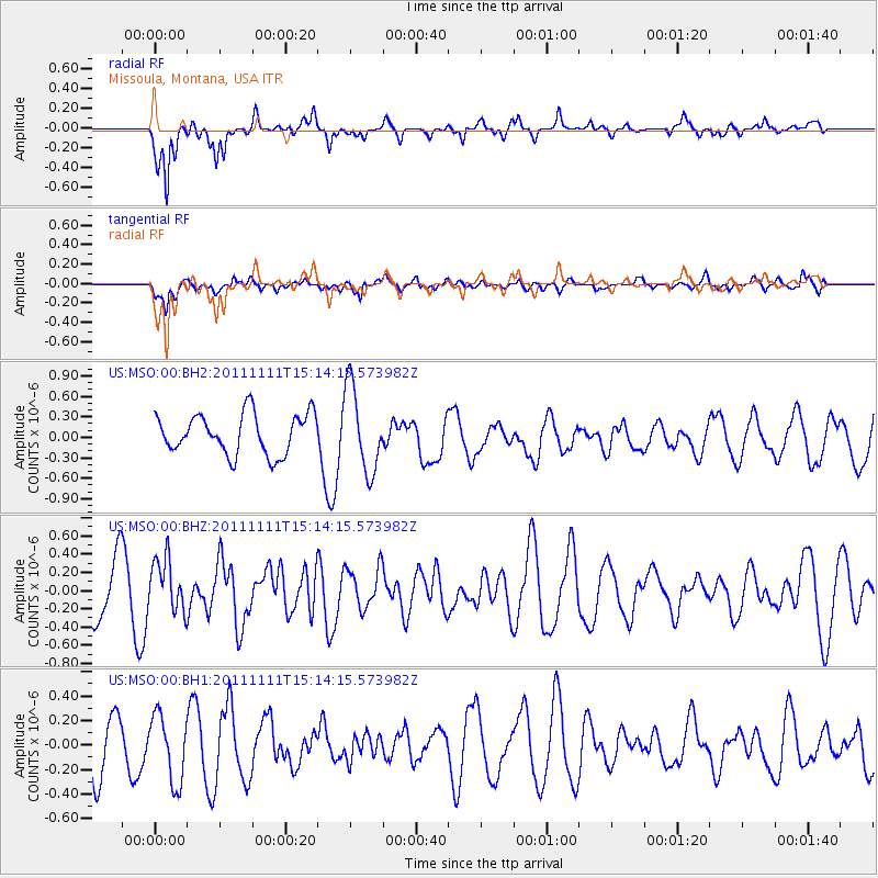
MSO Missoula, Montana, USA - Earthquake Result Viewer
*The percent match for this event was below the threshold and hence no stack was calculated.
| Earthquake location: |
Tonga Islands |
| Earthquake latitude/longitude: |
-17.7/-173.1 |
| Earthquake time(UTC): |
2011/11/11 (315) 15:02:19 GMT |
| Earthquake Depth: |
10 km |
| Earthquake Magnitude: |
5.5 MB, 5.6 MW |
| Earthquake Catalog/Contributor: |
NEIC PDE/NEIC PDE-M |
|
| Network: |
US United States National Seismic Network |
| Station: |
MSO Missoula, Montana, USA |
| Lat/Lon: |
46.83 N/113.94 W |
| Elevation: |
1264 m |
|
| Distance: |
83.4 deg |
| Az: |
36.405 deg |
| Baz: |
235.479 deg |
| Ray Param: |
$rayparam |
*The percent match for this event was below the threshold and hence was not used in the summary stack. |
|
| Radial Match: |
62.5208 % |
| Radial Bump: |
321 |
| Transverse Match: |
51.811283 % |
| Transverse Bump: |
400 |
| SOD ConfigId: |
558545 |
| Insert Time: |
2013-09-19 06:25:01.163 +0000 |
| GWidth: |
2.5 |
| Max Bumps: |
400 |
| Tol: |
0.001 |
|
Signal To Noise
| Channel | StoN | STA | LTA |
| US:MSO:00:BHZ:20111111T15:14:15.573982Z | 1.0945119 | 2.877534E-7 | 2.6290567E-7 |
| US:MSO:00:BH1:20111111T15:14:15.573982Z | 1.4518985 | 2.7484484E-7 | 1.8930031E-7 |
| US:MSO:00:BH2:20111111T15:14:15.573982Z | 2.1311023 | 6.228407E-7 | 2.9226223E-7 |
| Arrivals |
| Ps | |
| PpPs | |
| PsPs/PpSs | |


