You are here: Home > Network List > IU - Global Seismograph Network (GSN - IRIS/USGS) Stations List
> Station MAJO Matsushiro, Japan > Earthquake Result Viewer
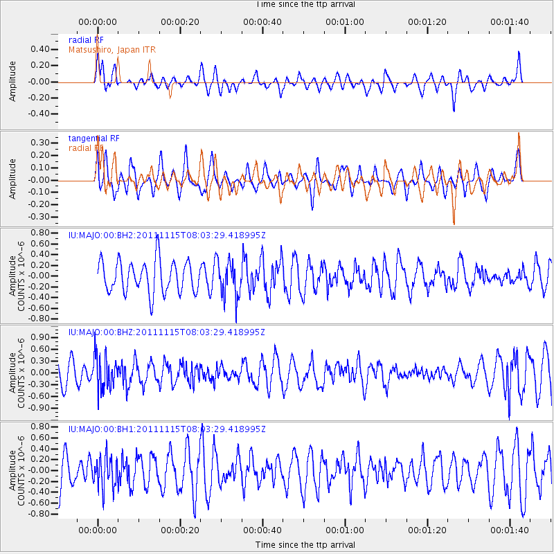
MAJO Matsushiro, Japan - Earthquake Result Viewer
*The percent match for this event was below the threshold and hence no stack was calculated.
| Earthquake location: |
Banda Sea |
| Earthquake latitude/longitude: |
-7.5/127.8 |
| Earthquake time(UTC): |
2011/11/15 (319) 07:56:02 GMT |
| Earthquake Depth: |
166 km |
| Earthquake Magnitude: |
5.8 MB, 5.5 MW, 5.5 MW |
| Earthquake Catalog/Contributor: |
WHDF/NEIC |
|
| Network: |
IU Global Seismograph Network (GSN - IRIS/USGS) |
| Station: |
MAJO Matsushiro, Japan |
| Lat/Lon: |
36.55 N/138.20 E |
| Elevation: |
405 m |
|
| Distance: |
44.9 deg |
| Az: |
11.842 deg |
| Baz: |
194.636 deg |
| Ray Param: |
$rayparam |
*The percent match for this event was below the threshold and hence was not used in the summary stack. |
|
| Radial Match: |
58.782177 % |
| Radial Bump: |
400 |
| Transverse Match: |
49.955482 % |
| Transverse Bump: |
400 |
| SOD ConfigId: |
558545 |
| Insert Time: |
2013-09-19 06:29:51.968 +0000 |
| GWidth: |
2.5 |
| Max Bumps: |
400 |
| Tol: |
0.001 |
|
Signal To Noise
| Channel | StoN | STA | LTA |
| IU:MAJO:00:BHZ:20111115T08:03:29.418995Z | 1.7531835 | 4.4000794E-7 | 2.5097654E-7 |
| IU:MAJO:00:BH1:20111115T08:03:29.418995Z | 1.0033525 | 2.8529337E-7 | 2.843401E-7 |
| IU:MAJO:00:BH2:20111115T08:03:29.418995Z | 1.0870653 | 3.2252055E-7 | 2.9668922E-7 |
| Arrivals |
| Ps | |
| PpPs | |
| PsPs/PpSs | |


