You are here: Home > Network List > GS - US Geological Survey Networks Stations List
> Station KAN10 Keim Farm > Earthquake Result Viewer
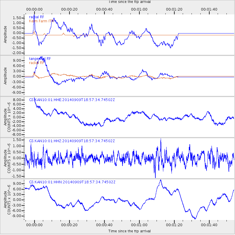
KAN10 Keim Farm - Earthquake Result Viewer
*The percent match for this event was below the threshold and hence no stack was calculated.
| Earthquake location: |
Tonga Islands Region |
| Earthquake latitude/longitude: |
-17.6/-173.0 |
| Earthquake time(UTC): |
2014/09/09 (252) 18:45:11 GMT |
| Earthquake Depth: |
10 km |
| Earthquake Magnitude: |
5.0 MW |
| Earthquake Catalog/Contributor: |
ISC/ISC |
|
| Network: |
GS US Geological Survey Networks |
| Station: |
KAN10 Keim Farm |
| Lat/Lon: |
37.12 N/98.10 W |
| Elevation: |
417 m |
|
| Distance: |
89.0 deg |
| Az: |
50.519 deg |
| Baz: |
247.099 deg |
| Ray Param: |
$rayparam |
*The percent match for this event was below the threshold and hence was not used in the summary stack. |
|
| Radial Match: |
67.65997 % |
| Radial Bump: |
400 |
| Transverse Match: |
75.07514 % |
| Transverse Bump: |
345 |
| SOD ConfigId: |
3390531 |
| Insert Time: |
2019-04-13 22:56:48.327 +0000 |
| GWidth: |
2.5 |
| Max Bumps: |
400 |
| Tol: |
0.001 |
|
Signal To Noise
| Channel | StoN | STA | LTA |
| GS:KAN10:01:HHZ:20140909T18:57:34.74502Z | 0.86807936 | 3.984839E-7 | 4.5904088E-7 |
| GS:KAN10:01:HHN:20140909T18:57:34.74502Z | 2.2127488 | 1.00999805E-5 | 4.5644497E-6 |
| GS:KAN10:01:HHE:20140909T18:57:34.74502Z | 3.187438 | 5.6574945E-6 | 1.7749347E-6 |
| Arrivals |
| Ps | |
| PpPs | |
| PsPs/PpSs | |


